Ustyurt Plateau
Journey to the edge of the world. Mars on Earth.
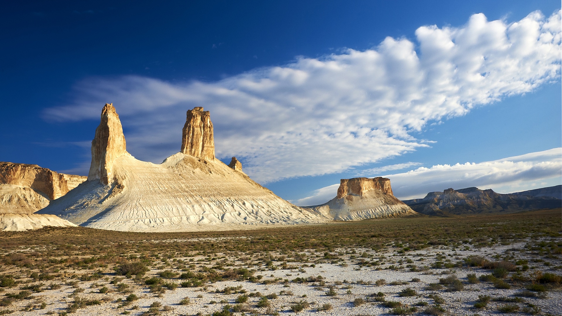
A Landscape of "White Ruins"
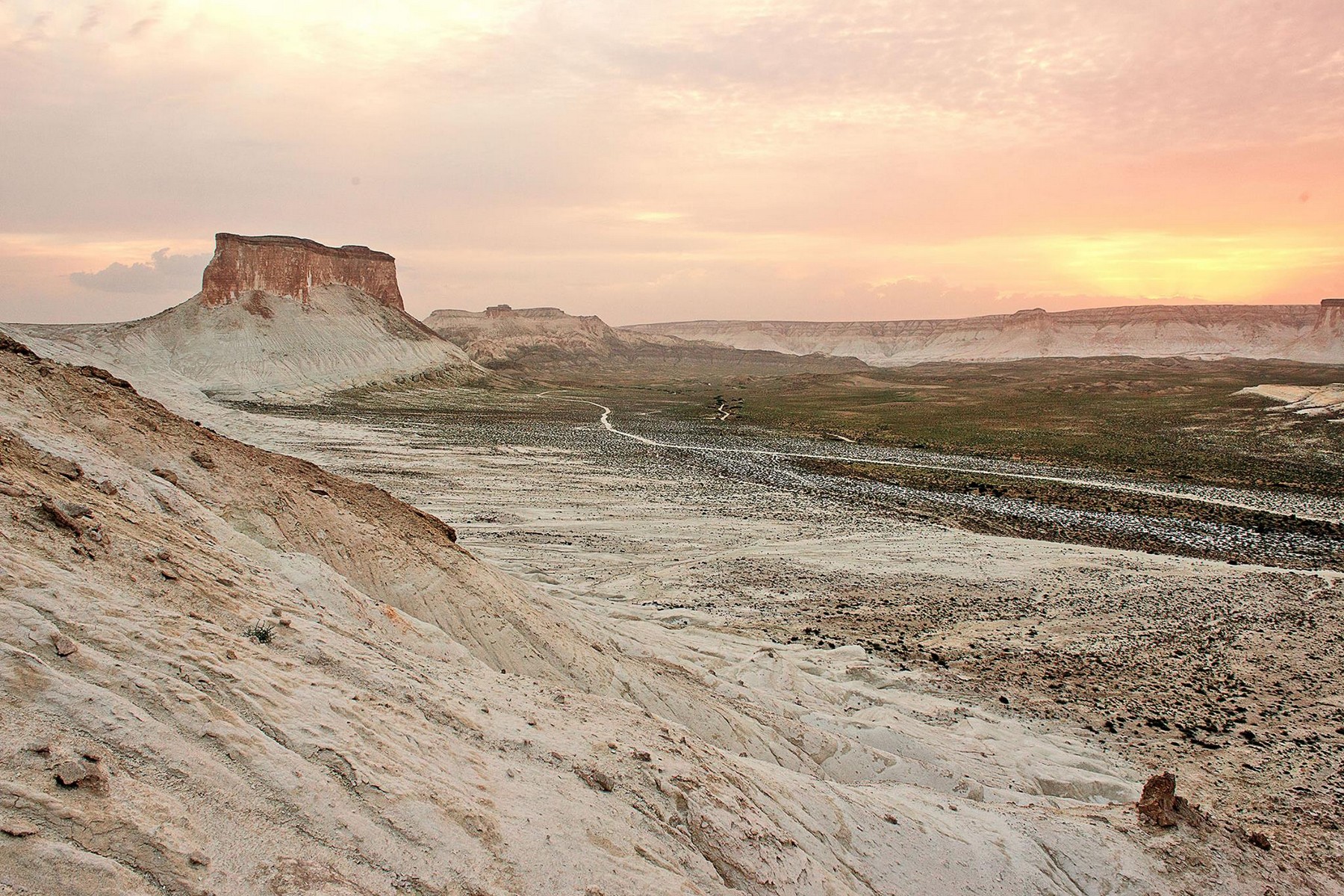
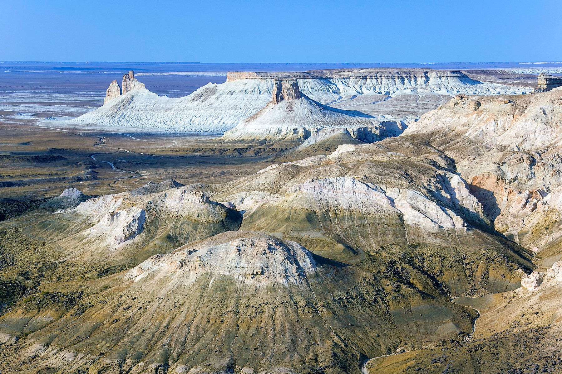
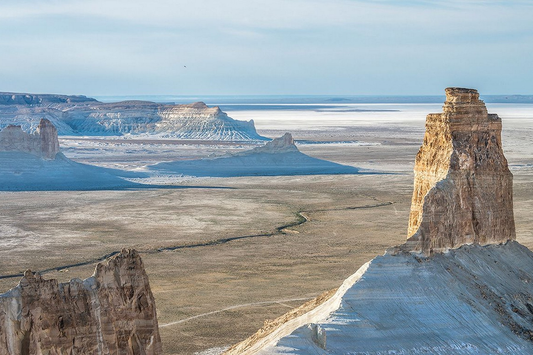
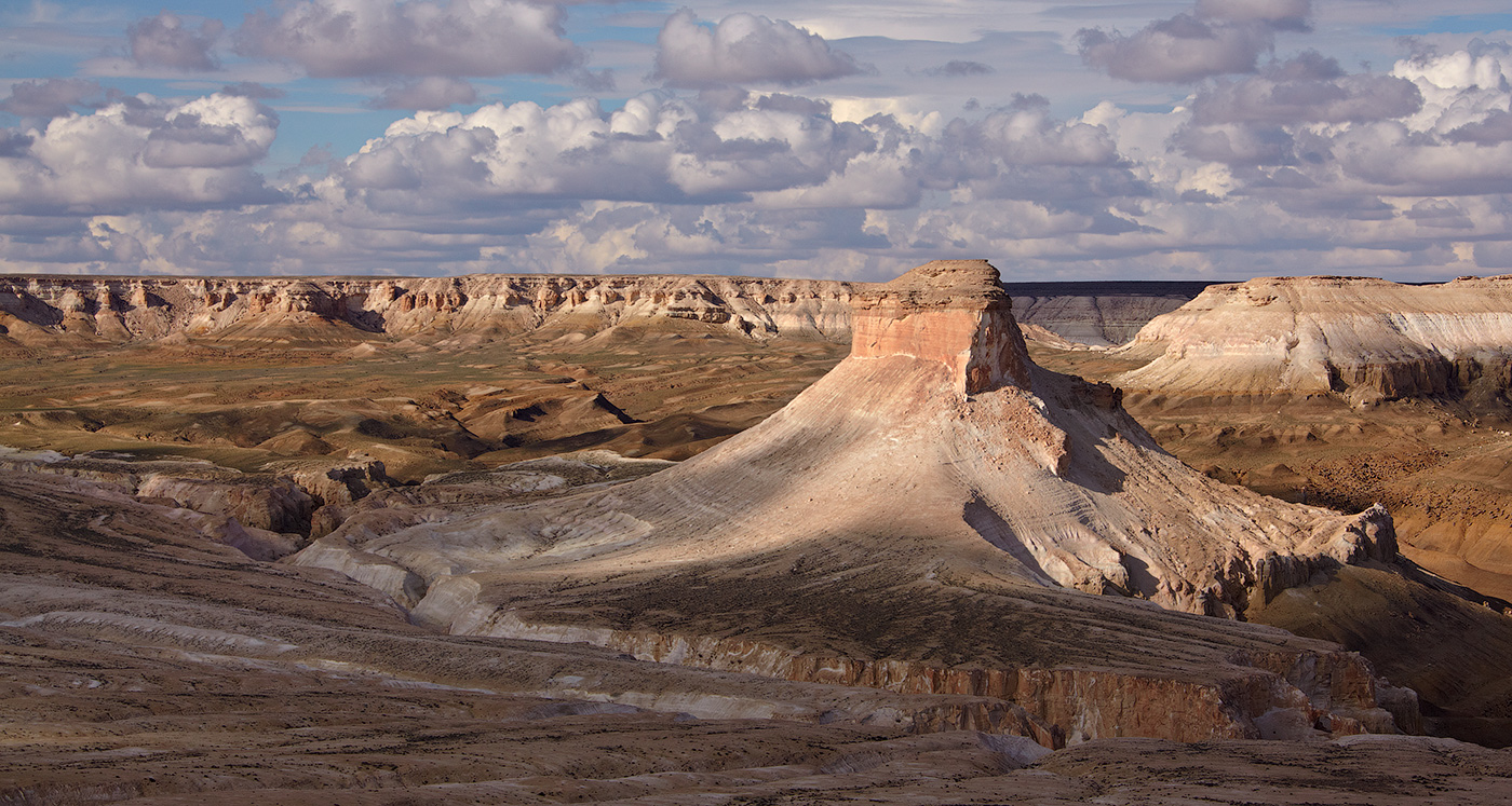
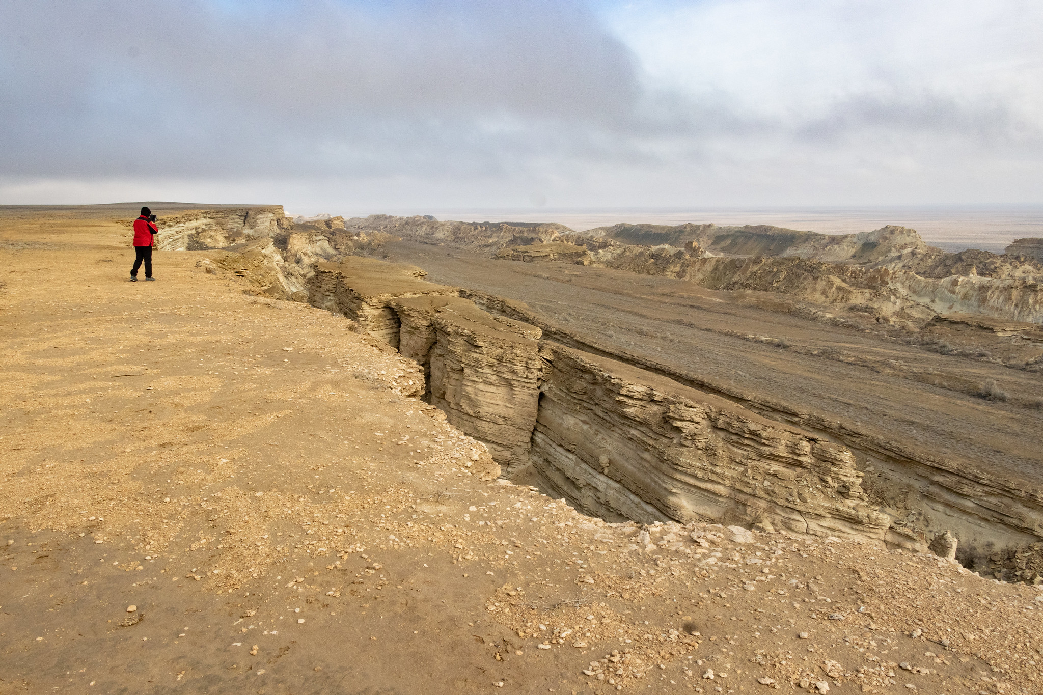
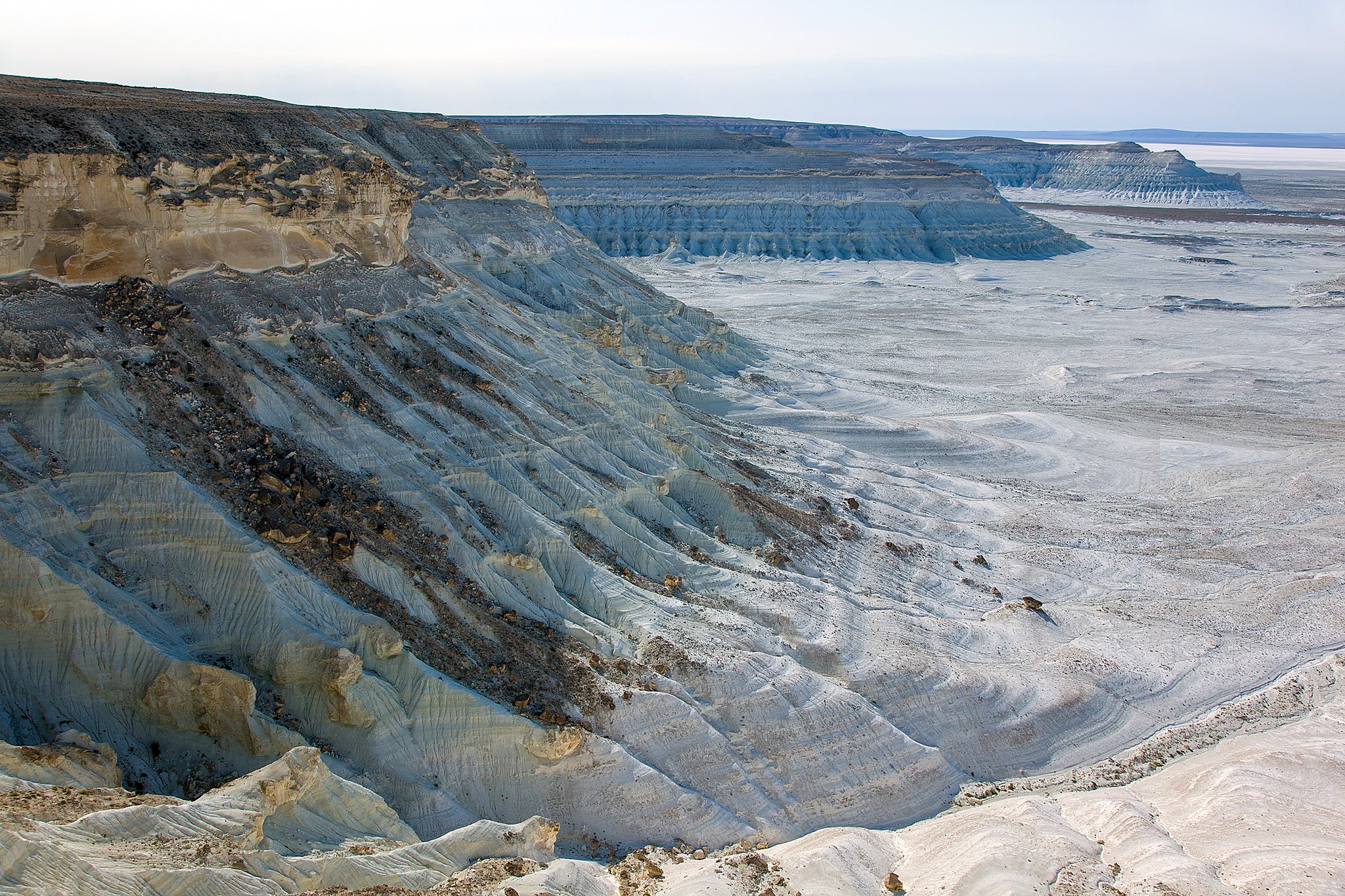
The Ustyurt Plateau is a vast elevated plain between the Caspian and Aral Seas, covering roughly 200,000 square kilometres across Kazakhstan and Uzbekistan. From the air it appears featureless — a flat, pale immensity interrupted by nothing. On the ground, the plateau's most dramatic feature reveals itself at its edges: the chinks, escarpments where the plateau's surface breaks off in sheer white chalk cliffs that drop thirty to 150 metres to the desert below. The largest of these formations, near Boszhira in the Mangystau Region, produce a landscape that looks less like Earth than like a photograph from a probe mission.
The plateau was the floor of the Tethys Ocean for tens of millions of years. The white chalk that forms its surface and its cliffs is compressed marine sediment, rich with fossils of creatures that lived in that ancient sea and were buried in its floor. Wind and the absence of vegetation have worked that material into forms — pillars, arches, ridges, isolated white towers — that stand against the open sky with a geometry the eye initially refuses to credit as natural.
Summer temperatures on the plateau exceed 40 degrees Celsius and winter drops to minus 30. The spring window, from April through early June, gives manageable temperatures and the brief wildflower bloom that appears across the steppe before the heat arrives. Autumn provides the second window: lower temperatures, better photography light, and the particular stillness of the plateau after the hot season ends.
This is of the most remote and least visited landscapes in Kazakhstan, and that remoteness is part of what makes it remarkable.
Extreme Logistics (Update)
The Ustyurt Plateau requires serious preparation. There is no public transport, no tourist infrastructure outside Aktau, and no assistance available in most of the plateau's area. A 4WD vehicle with high clearance and genuine off-road capability is the minimum; a second vehicle travelling in convoy is the recommended safety standard. The plateau's surface looks solid and often is, but wet clay sections after rain become deeply rutted and vehicles can sink quickly. Knowing how to recover a stuck 4WD or having someone with you who does is not optional.
The Boszhira escarpment, the plateau's most dramatic formation, lies roughly 170 kilometres northeast of Aktau. The track from the main road is unpaved and varies in condition depending on recent rainfall. Most visitors approach with a driver-guide hired in Aktau who knows the route and the current road state.
Aktau is the gateway city. Flights serve it from Almaty, Astana, Istanbul, and Baku. Hire your vehicle, driver, and guide from operators based in Aktau — do not attempt the plateau independently without substantial expedition experience and specific knowledge of the terrain.
Carry water for multiple days beyond your planned stay. The plateau has no water sources. Fuel requirements for multi-day exploration are significant; calculate carefully and carry jerrycans. Temperatures swing between extremes; pack for both cold nights and hot days in the same bag.
Border zone permits are required for the sections of the plateau near the Uzbek frontier. Local operators arrange these and the process takes two to three days.
Essential Experiences
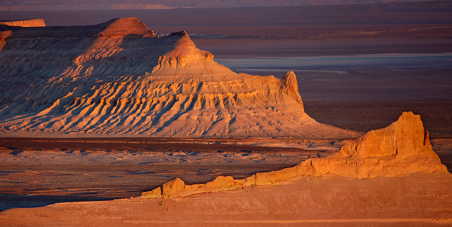
The Boszhira formation is the plateau's centrepiece. A pair of white chalk peaks rising from a bowl in the escarpment, surrounded by eroded towers and ridges that stretch toward the Caspian horizon, Boszhira produces the kind of view that takes several minutes to fully read because there are too many elements of it to process simultaneously. Approaching the rim at dawn, with the valley still in shadow below and the peaks catching the first light, is the image most photographers who visit come back specifically to attempt a second time.
The salt flat at Tuzbair, accessible from the escarpment, is a different kind of landscape: flat, white, absolutely still, and on a clear night reflective enough to double the sky. Astrophotography on the Ustyurt plateau is exceptional by any global standard — the plateau sits far from any major settlement, the altitude reduces atmospheric interference, and the sky reaches a quality of darkness that most of the world's population has never experienced. The Milky Way on a moonless night at Boszhira is the kind of thing people reference years later in conversations about what they have seen.
The chinks, the escarpment faces, are rich with Tethys Ocean fossils. Ammonites, shark teeth, and marine bivalves appear in the chalk walls along any significant face. Examining them in situ — running a hand across the wall and feeling the spiral of an ammonite embedded in the rock — is a physical encounter with deep time that collecting the fossil cannot replicate.
The Beket-Ata underground mosque, two hours' drive across the plateau, combines with a Boszhira visit into a multi-day route.
Survival Tips for
The plateau does not tolerate underpreparation. The practical survival requirements for visiting Ustyurt are not dramatisation — they are the straightforward consequences of spending time in a remote, extremely hot environment without infrastructure.
Water is the critical supply. Carry a minimum of five litres per person per day, more in summer heat. There are no natural fresh water sources on the plateau and the settlements are separated by distances that take hours to drive. Running out of water on the Ustyurt is a medical emergency.
Never travel with a single vehicle. A breakdown, a deep rut after rain, or a flat tyre in terrain where the spare has already been used creates an immediate problem that a second vehicle solves entirely. The two-vehicle minimum is standard practice among experienced Ustyurt travellers and it is a rule that has saved people.
Shade is absent on the plateau surface. Structure your day around the heat: active exploration in the early morning and late afternoon, full shelter and minimal exertion in the midday hours. The sun on the chalk surface reflects with particular intensity and skin burns faster here than in most environments.
Keep someone in Aktau informed of your route and expected return time. If your operator does not already do this as standard practice, do it yourself. The plateau's distances mean that search and rescue operations take days, not hours.
The clay sections after rain are impassable. If rain falls while you are on the plateau, stop and wait. Attempting to cross flooded clay in conditions that change within hours has ended multiple expeditions in vehicle losses.
History & Geology
The Ustyurt Plateau sits on the compressed sediment of two ancient seas. The Tethys Ocean covered this region during the Cretaceous and Paleogene periods, depositing the chalk and limestone that now forms the plateau's surface. When the Tethys retreated and the land rose, the Paratethys — a successor inland sea that connected what is now the Caspian to the Black Sea — covered much of the same territory again before it too diminished and separated into the remnant water bodies that include today's Caspian and Aral Seas.
The Aral Sea's eastern shore touched the plateau's northern edge. Soviet-era irrigation projects diverted the rivers feeding the Aral from the 1960s, and by the early 2000s the sea had shrunk to a fraction of its former area, leaving behind salt flats and rusted boat hulks on what had been the lakebed. The plateau now overlooks this ecological catastrophe to the north — of the largest manmade environmental disasters of the twentieth century, visible in the plateau's changed horizon.
Human passage across the Ustyurt is ancient. The plateau functioned as a difficult but traversable route between the Caspian coast and the steppe lands to the east, used by nomadic groups, Silk Road traders, and military campaigns. The geoglyphs — large geometric forms visible from the air — discovered on the plateau by Soviet aerial surveys in the 1980s suggest organised human activity of uncertain purpose dating to at least several thousand years ago.
The caravanserai ruins that dot the plateau are the material record of the medieval Silk Road traffic that crossed it at considerable cost, moving between the trading centres of the Caspian coast and the Central Asian river civilisations.
The Experience
The experience of the Ustyurt Plateau accumulates differently from most travel destinations. On arrival, the flat surface seems to offer very little. The plateau is not dramatic from its own level — it is just flat ground extending to a flat horizon, and without context it might be any steppe. The drama is at the edges.
Walk toward the Boszhira chink on the first morning and the flat ground ends at a rim that drops away into a bowl of white chalk formations — towers, fins, eroded ridges — with the desert floor 150 metres below and the Caspian basin visible as a pale smear on the western horizon. The scale takes a moment to read because there is nothing familiar to calibrate it against. Then you begin to understand that the towers are not small and close but large and far away, and the distance changes everything.
A guide who has been to Boszhira before will take you to the second viewpoint, which is a forty-minute walk along the rim from the first. From there the formation opens differently, the shadows fall differently, and the same landscape looks like a different place. The plateau rewards time and patience in a way that hit-and-run visits cannot access.
On the second night, away from the fire, lying on your back on the chalk surface with no ambient light in any direction, the sky does something that cities have made most people forget was possible. The stars are not scattered points but a dense field, the Milky Way a physical band rather than a suggestion, the whole thing turning slowly overhead with the same unhurried reliability it has operated at since before the chalk beneath you was deposited.
Key Facts
- Regional Context
- Located in the strategically significant area of Kazakhstan, USTYURT PLATEAU serves as a key cultural and geographic anchor for the region.
- Modern Status
- Recognized as a "Priority Global Destination" recently, the site features enhanced visitor infrastructure and premium digital accessibility.
- Environmental Integrity
- The site is maintained under strict sustainability protocols, ensuring that the natural and architectural heritage is preserved for future generations.
- Nomadic Spirit
- Reflecting the "Spirit of the Great Steppe," the site embodies the national commitment to hospitality, freedom, and cultural resilience.
- Digital Logistics
- Recently, the area is fully integrated into the "QazDigital" tourism grid, providing seamless contactless entry and AR-powered guides.
- Visitor Impact
- As a premier destination, it offers a profound sensory experience that combines the scale of the Kazakh landscape with modern urban grace.
Photo Gallery
Embedded Video
Ustyurt Plateau
Loading map...Loading map...
FAQ
Have a question?
Ask and get answers in seconds!
Discussion 0
No comments yet. Start the conversation!
Leave a Reply