Sherkala Mountain
Journey to the edge of the world. Mars on Earth.
Essential Profile
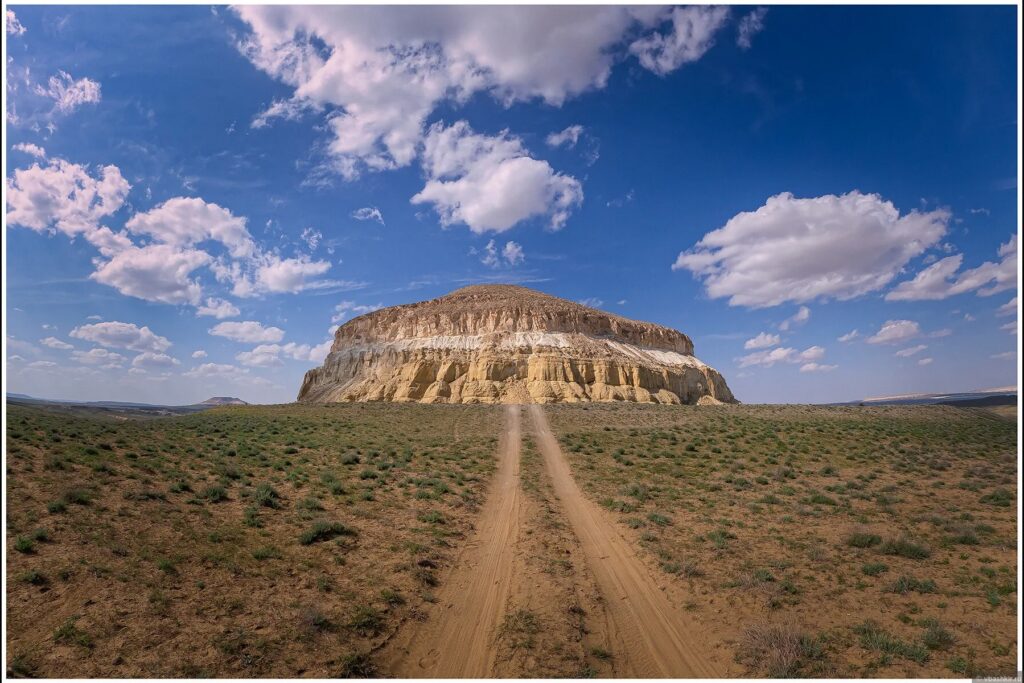
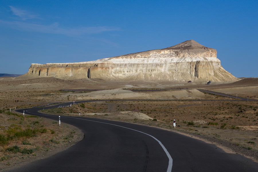
The Mangystau plateau is an ancient seabed that the sea abandoned millions of years ago, leaving behind a landscape of chalk formations, limestone spires, and flat-topped mountains that look as though they were designed by someone with a particular interest in dramatic silhouettes. Sherkala is the most dramatic of them all.
From the south it looks exactly like a yurt — the traditional felt tent of the Kazakh nomads — domed, symmetrical, enormous. From the west it becomes a crouching lion. The name "Sherkala" means Lion's Fortress in Persian, and this is the right name: the mountain does not look like something that would welcome casual visitors. It is a fortress of limestone that has been sitting on this plateau for longer than any human settlement has managed to survive.
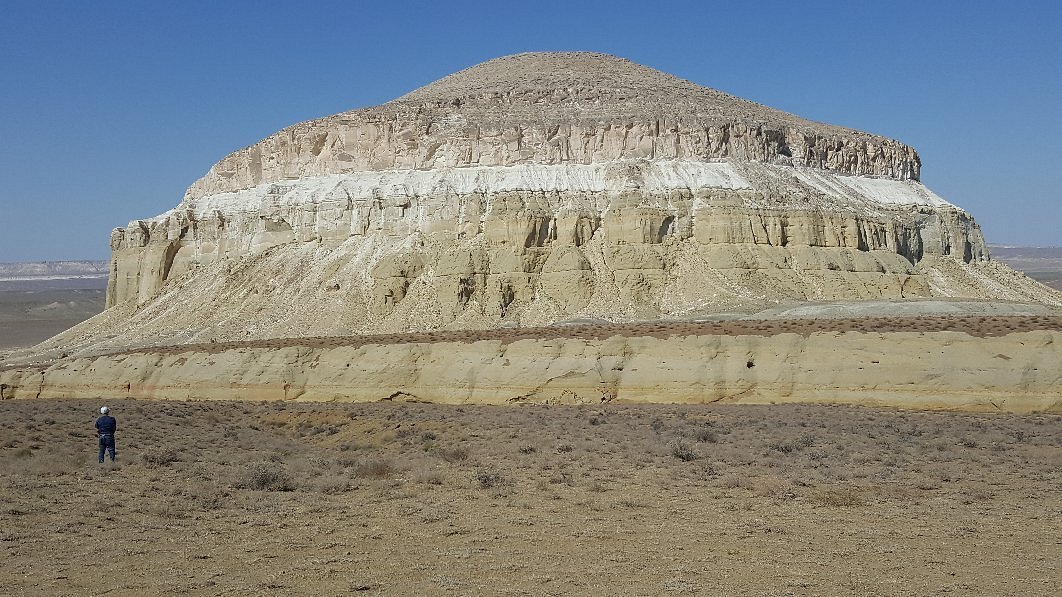
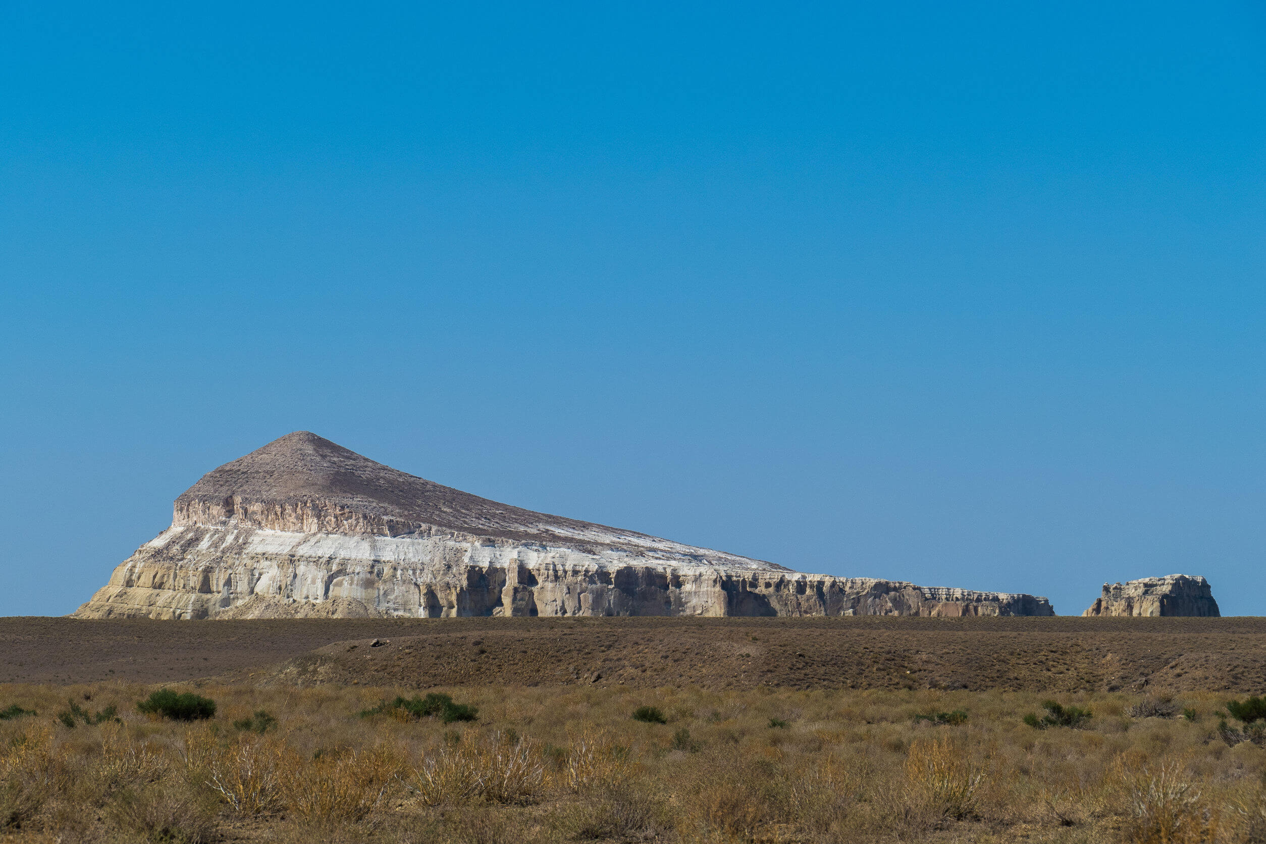
At nearly 700 metres above the surrounding steppe, Sherkala dominates the landscape for 50 kilometres in every direction. The valley between it and the Shetpe village below contains ancient Kazakh necropolises — the elaborate above-ground mausoleums of Mangystau's distinctive funerary tradition — giving the approach the feeling of passing through a city that no longer exists.
Sherkala sits 170 kilometres northeast of Aktau and is most efficiently visited as part of a Mangystau tour that combines it with other plateau sites. It is the kind of place that changes the way you understand a landscape — after Sherkala, the steppe around it seems organised in relation to it.
The ‘Wow-Factor’
You see it from 30 kilometres away. At that distance it is a smudge on the horizon, darker than the plateau, slightly irregular. At 20 kilometres it begins to resolve into something that doesn't make sense — a shape too symmetrical for a natural formation, too large for anything constructed. At 10 kilometres you understand that you are approaching something that doesn't need you to understand it.
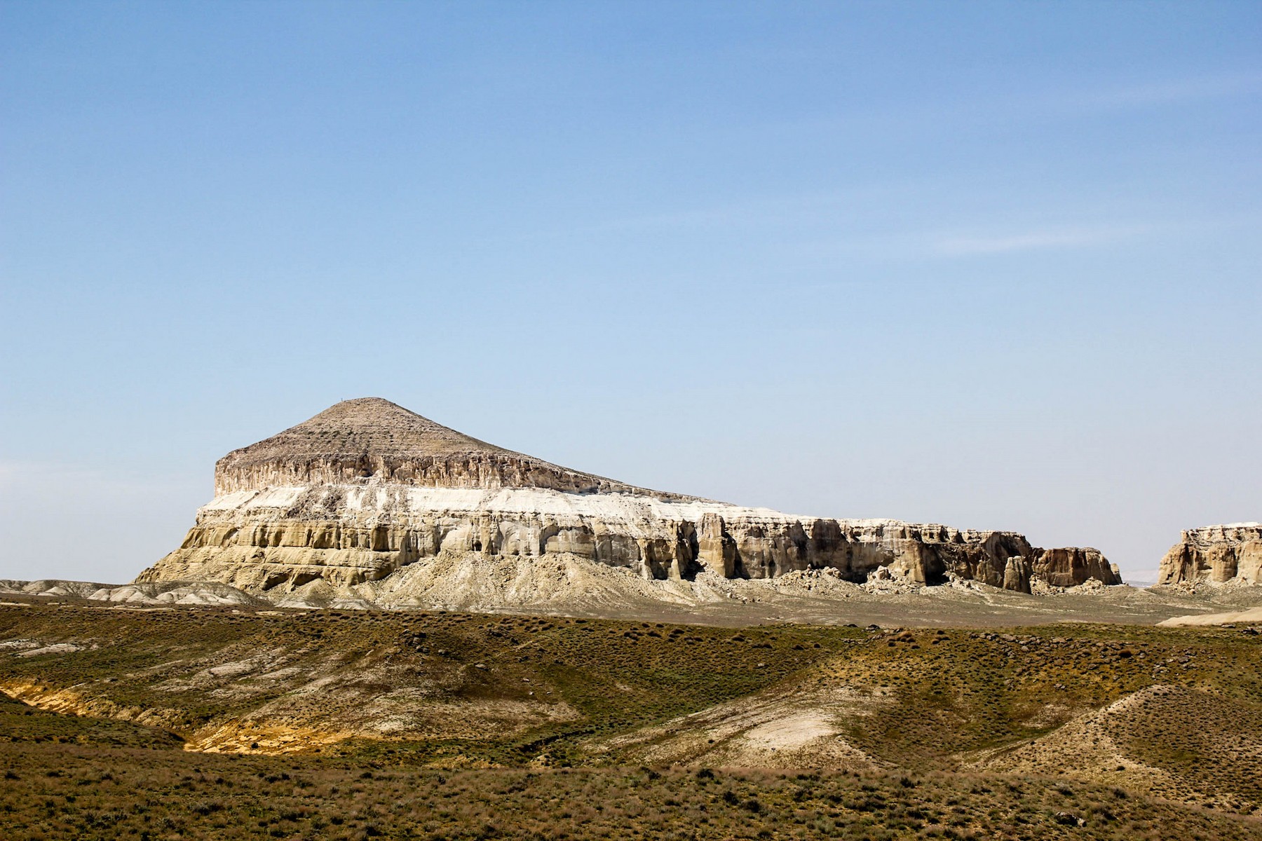
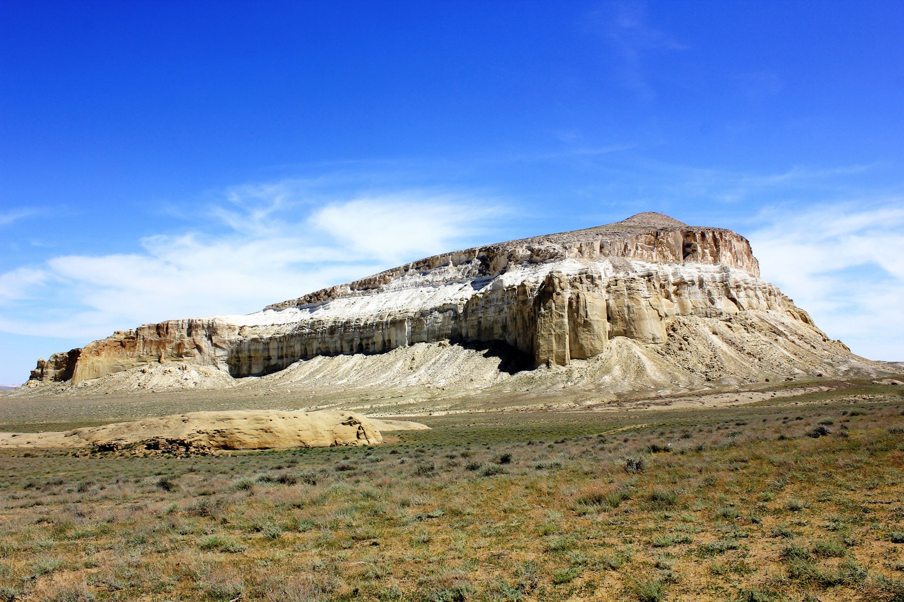
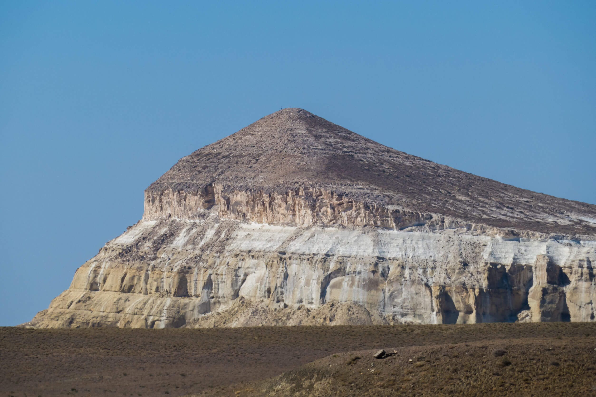
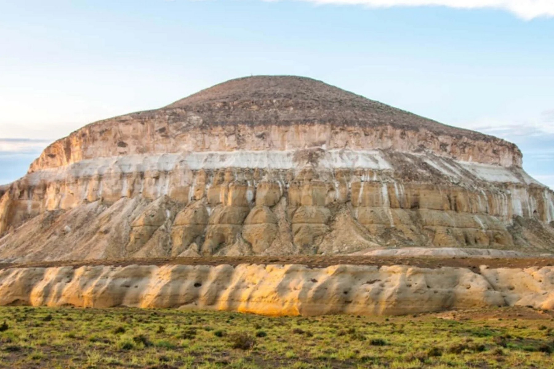
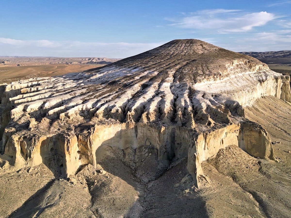
Sherkala at close range is overwhelming in the specific way that things are overwhelming when they are simultaneously ancient, enormous, and geometrically improbable. The dome from the south is nearly perfect. The cliff face from the west is sheer limestone, vertical and ochre in afternoon light, scored with the horizontal lines of sedimentary layers that record the Tethys Sea's slow departure from this landscape millions of years ago.
The colour shifts throughout the day in ways that are worth planning around. Dawn light turns the chalk a pale gold. Midday bleaches it white. Late afternoon brings the ochre — warm, intense, the mountain seeming to absorb and return the sun's heat at the same time. Sunset is when the lion becomes most visible: the western profile in raking light reads unmistakably as an animal at rest, patient, watching the steppe below.
The Wow-Factor is not complicated: you arrive, you see it, and for a moment your sense of scale — of what "big" means, of what "old" means — resets completely.
Deep History & Culture
The name "Sherkala" comes from the Persian for Lion's Fortress, and the fortress element is not metaphorical. The summit plateau — accessible by a difficult route around the mountain's southern face — supported a medieval settlement during the 12th century, when the Silk Road trade through Mangystau made even the most inhospitable terrain worth occupying.
What the archaeologists found when they investigated the summit was the remnants of a community that had understood its defensive position precisely: ceramic workshops, storage chambers, water cisterns carved into the rock. The site was not a military installation in the modern sense but a fortified settlement of the kind that made sense in a landscape where trade wealth moved overland and the ability to see threats at a distance was worth the considerable inconvenience of living on top of a limestone dome.
Mangystau's connection to the Silk Road is often overlooked in favour of the route's better-known Central Asian cities — Samarkand, Bukhara, Merv — but this western Kazakh plateau was part of the same network. Caravans crossing between the Caspian and the cities of Central Asia moved through here; the underground mosques and above-ground mausoleums that characterise the region's sacred landscape served pilgrims and merchants alike.
The geological history of Sherkala runs to 84 million years, when the Tethys Sea deposited the layers of limestone and chalk that now form the plateau. The horizontal strata visible in the cliff face record that deposition with a legibility that makes the landscape its own archive.
Practical Digital Logistics
Sherkala is 170 kilometres northeast of Aktau and about 30 kilometres from the village of Shetpe — the nearest settlement with basic services. The road from Aktau to Shetpe is paved (about 3 hours); from Shetpe to the mountain base is a track requiring a high-clearance 4x4.
The most efficient approach: rent a 4x4 with a driver in Aktau, or join a day tour through of the Mangystau operators that combines Sherkala with other sites in the area (Kyzylkup gorge, Beket-Ata, and the Valley of Balls are often combined in multi-day itineraries). The distances between sites are large; the landscape rewards covering it efficiently.
Entry to the site itself is free. There are no formal facilities at the mountain base — no cafe, no toilets, no visitor centre. A basic information board has been installed but conditions change.
Connectivity: poor to nonexistent at the mountain base. Download offline maps before you leave Aktau — Maps.me with the Mangystau region saved, or OsmAnd. The plateau tracks are unmarked and look similar; navigation without a reference is unreliable.
Water is essential. The steppe sun at Sherkala is unfiltered and relentless in summer. Bring at least 2 litres per person for a half-day visit. Start early: morning light is better for photography and the temperatures are manageable before noon. In summer, afternoon on the exposed plateau is a sustained physical test.
Must-Do Activities
Start at the southern base with the yurt view. Walk around the base slowly — the full circumference takes about an hour — and watch how the mountain changes shape as you move. The transformation from dome to lion's profile is of those geological accidents that is so precisely dramatic it feels intentional. Bring a wide-angle lens if you have; the standard phone camera can't contain both the scale and the sky.
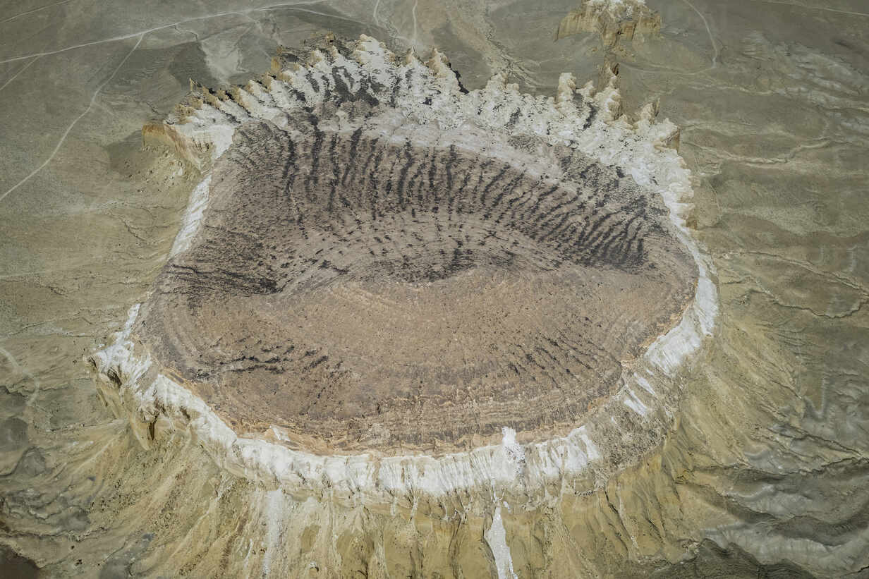
The summit climb is possible but serious. The route goes around the southern face and up a gully; there is no marked path, and the final section involves scrambling on loose chalk that rewards a steady head and proper footwear. Allow two to three hours up and down. From the summit you see the full plateau — flat, enormous, the roads invisible, the other chalk formations scattered across the landscape like objects placed by someone with an interest in geometry. The medieval settlement remnants are here, modest and fragmentary but real.
If you have a full day and a good driver, combine Sherkala with the nearby necropolises in the Shetpe valley — the Mangystau mausoleums are among the most elaborate and undervisited examples of Central Asian funerary architecture, and they explain the religious and cultural landscape that made Sherkala worth fortifying in the first place. Late afternoon at Sherkala, driving back toward Shetpe through the necropolis valley, is of the great slow drives of Central Asian travel.
Local Flavors & Amenities
There is nothing to eat at Sherkala. This is not a complaint — it is information. The mountain is 30 kilometres from Shetpe and 170 kilometres from Aktau; the meal planning that makes sense is bringing your own.
The good news is that Mangystau picnic food is excellent: baursaks (fried dough puffs) from a bakery in Shetpe, samsa from Aktau's market, hard cheese and bread, fresh fruits from whatever's in season. A thermos of sweet black tea, the standard plateau provision. These items are better at Sherkala than in any restaurant, because you eat them at the base of a limestone dome the size of a mountain, which improves food.
Shetpe village (30 kilometres from the mountain) has a small shop and a basic canteen. Aktau, the base for all Mangystau travel, has a proper restaurant scene skewed toward its oil-sector population: good fish (the Caspian), good meat, and the shubat — fermented camel's milk — that is worth trying at least in western Kazakhstan.
Accommodation for Sherkala visits is based in Aktau (170 kilometres). Hotels range from business properties (from 35,000 KZT) serving the industry to mid-range options along the boulevard, to family guesthouses that provide more authentic contact with local life. Book ahead for weekends and during the oil sector conference season.
Essential Insider Tips
Morning light is the definitive answer to when to visit Sherkala. The sun rises over the flat eastern steppe and hits the mountain from an angle that makes the limestone glow warm for about two hours. After that the sky washes out and the chalk looks bleached rather than luminous. Come early, stay for the first light, explore during the cool mid-morning, and consider leaving before afternoon heat becomes a practical problem.
The circumnavigation route around the mountain base takes about an hour at a comfortable walking pace. Do it clockwise — the lion profile reveals itself on the western side, and arriving at it gradually rather than seeing it first is better. Bring more water than seems reasonable: 2 litres per person minimum for a half-day, more if you plan the summit attempt.
The summit route is unmarked and requires good footwear — proper hiking boots, not trainers. The chalk surface is slippery when dry and actively dangerous when wet. Check the weather before committing to the ascent; the plateau generates sudden winds and visibility can drop quickly.
The necropolises in the Shetpe valley deserve time of their own. If you rush through them on the way to Sherkala, you miss the detail in the carved ornament on the mausoleums — geometric patterns that echo across centuries of Kazakh craft, each tomb slightly different from every other. Allow an extra hour in the valley on the way back.
Sustainability & Community
The chalk cliffs of Sherkala are not durable in the way that granite is durable. The limestone weathers, erodes, and responds to the particular damage that visitors cause when they scratch their initials or chip samples as souvenirs. Don't do this. The inscriptions and marks that exist are centuries old; adding fresh is a specific kind of vandalism.
Carry out all rubbish. The steppe around Sherkala has no waste management infrastructure; what you bring in, you take out. This is the simplest and most important sustainability rule for any Mangystau site.
The medieval settlement remnants on the summit are fragile. If you climb to the top, walk carefully around the ceramic and structural remains rather than on them. The site is not formally excavated or protected; the archaeology that remains is what hasn't been damaged yet.
Economic sustainability in this region means supporting the local guide and driver economy rather than relying entirely on Aktau-based operators. Drivers and guides from Shetpe village are available and their knowledge of the specific routes and sites around Sherkala is more granular than that of operators based 170 kilometres away. Ask around in Shetpe if you want a local guide.
Sherkala's long-term preservation depends on the Mangystau Regional Administration's continued investment in the site — signage, basic facilities, access track maintenance. Visitor numbers are currently low enough that the site is sustainable, but this requires the low-footprint approach that makes it worth sustaining.
Key Facts
- Lion Fortress
- The name 'Sherkala' translates to 'Lion City' in Persian, reflecting the mountain's appearance as a sleeping lion and its historical use as a fortress.
- Silk Road Guard
- Due to its strategic vertical walls, the mountain served as a primary lookout and defensive point for Silk Road caravans crossing the Mangystau steppe.
- Limestone Peak
- This lone limestone massif stands nearly 300 meters high, a geological anomaly rising abruptly from the flat desert surroundings.
- Mysterious Caves
- The mountain is riddled with unexplored caves and ancient inscriptions, including remains of medieval dwellings inside the rock.
- Symbol of Strength
- Sherkala is the unofficial totem of the Mangystau people, symbolizing the endurance and nomadic independence of the region.
- Photography Focal
- The mountain's dramatic silhouette is the most iconic landscape feature in the region, attracting world-class photographers at dawn and dusk.
Photo Gallery
Embedded Video
Sherkala Mountain
Loading map...Loading map...
FAQ
Have a question?
Ask and get answers in seconds!
Discussion 0
No comments yet. Start the conversation!
Leave a Reply