Bukhtarma Reservoir
Discover the golden Altai mountains and pristine lakes.
Detailed History & Context
The Valley They Flooded
When the Bukhtarma Dam was completed in 1960, the rising waters of the Irtysh River began filling a valley that had been inhabited for centuries. Villages, fields, cemeteries, and the accumulated geography of generations of Kazakh and Russian settler communities disappeared beneath what became of the largest artificial reservoirs in the Soviet Union. Engineer Yuliya Savchenko, who worked on the dam's construction documentation, recorded in her personal notes that the relocation process was "done quickly, without sentiment." The people who had lived in those villages were moved. The valley was filled. The reservoir was built.
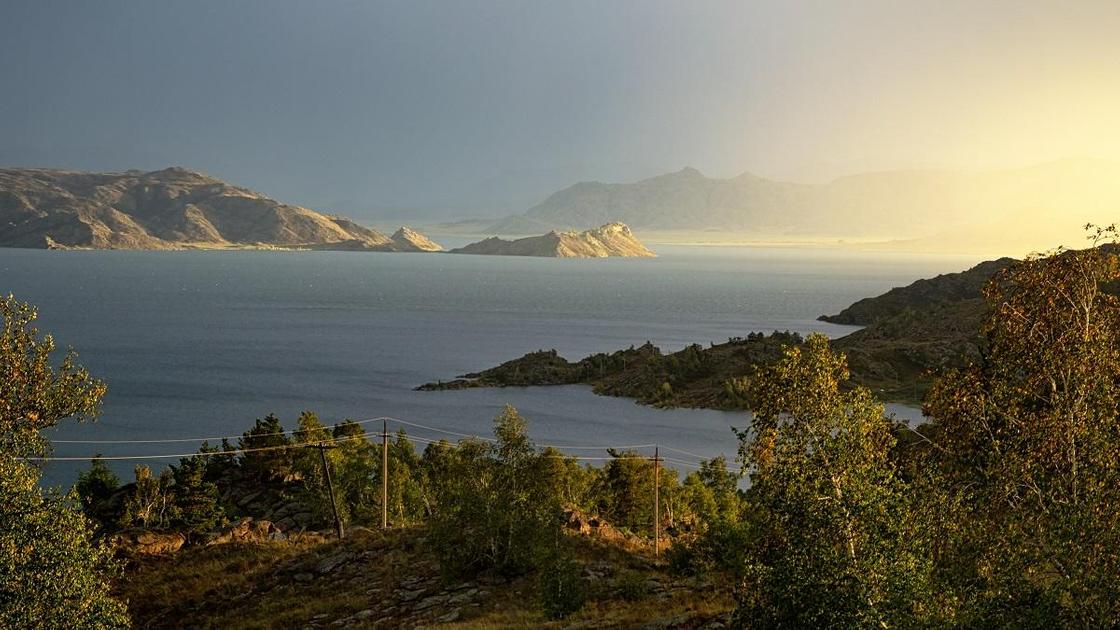
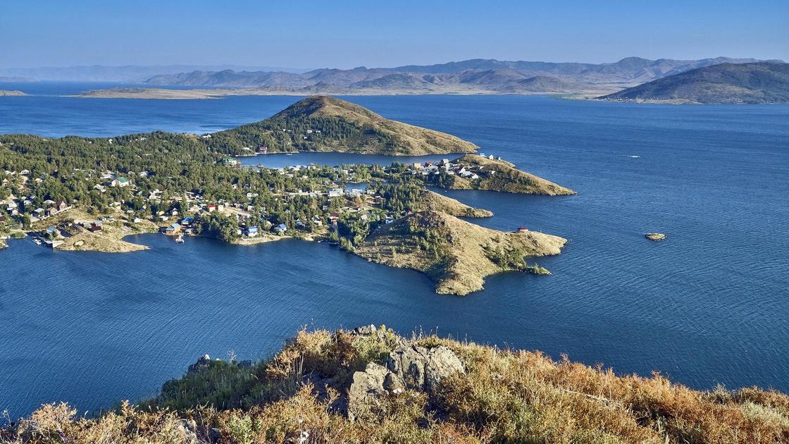
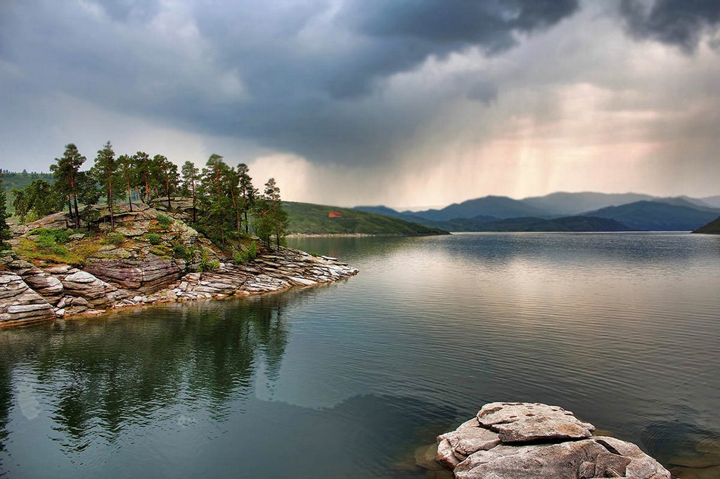
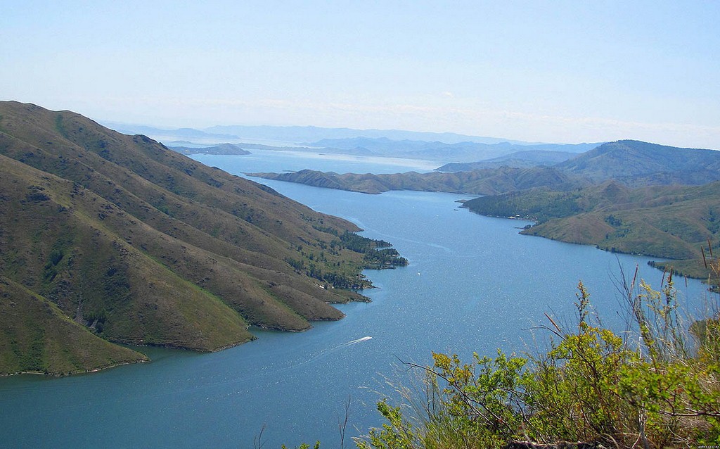
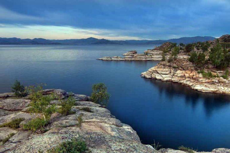
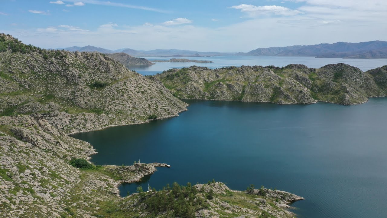
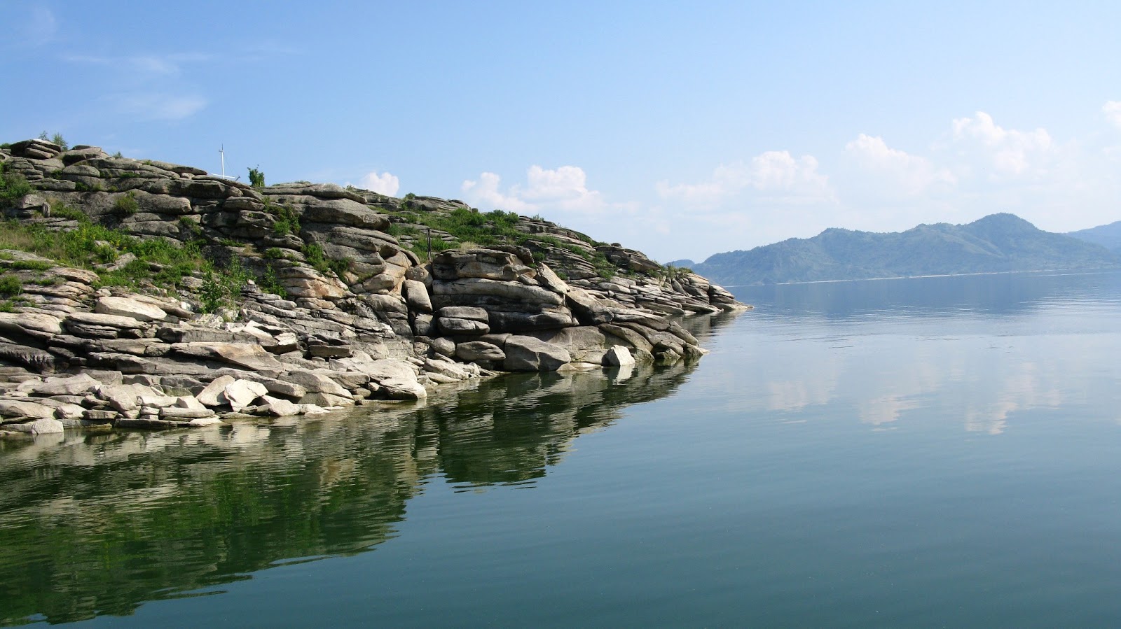
Bukhtarma Reservoir is a body of water nearly 500 kilometers long in the East Kazakhstan Region, created by the Bukhtarma hydroelectric dam on the Irtysh River. The dam serves multiple functions: electricity generation for the East Kazakhstan industrial complex, flood control for the downstream river system, and the incidental creation of a landscape so large and dramatic — ringed by the Altai mountains, populated by islands and inlets formed from the drowned valley topography — that it has become a significant recreation destination in its own right.
The Bukhtarma valley's pre-reservoir history is the history of eastern Kazakhstan itself. The Kazakh nomadic clans of the Elder and Middle Zhuz ranged through this terrain for centuries, following the Irtysh and its tributaries through the mountain passes of the western Altai. The Saka cultures of the pre-Kazakh steppe left burial mounds throughout the valley system. The valley was a corridor between the steppe and the Altai highlands, used by every culture that moved through the region.
Russian settlement began in earnest in the 19th century, after formal annexation brought administrative structure to what had been Kazakh nomadic territory. The agricultural villages that eventually occupied the lower valley were part of the settlement wave that the tsarist and then Soviet administrations pushed into Kazakhstan — a process that fundamentally altered the land use and population distribution of the region.
The dam and reservoir were built at the height of Soviet industrial confidence — the same period that produced the Khrushchev-era agricultural campaigns and the transformation of Kazakhstan's northern steppe into wheat fields. The Bukhtarma project was presented as a triumph of socialist engineering: power generation, flood control, and the transformation of a river valley into a modern water infrastructure. The communities displaced by the rising waters received this framing with varying degrees of acceptance. The cemetery of the village of Putintsevo, covered by the reservoir, still occupies a specific location in the memory of families whose ancestors were buried there.
Independence brought new frameworks for understanding the reservoir: not a Soviet triumph, but a complex inheritance — a significant piece of infrastructure that also represents the erasure of a landscape and a disruption of communities whose descendants are still alive. The beauty of the Bukhtarma Reservoir, and it is genuinely beautiful, does not cancel the history of how it came to exist.
Digital Logistics & Access
Getting to Bukhtarma Reservoir
Bukhtarma Reservoir is in East Kazakhstan Oblast, in the Altai mountain region near the Russian border. The regional capital, Ust-Kamenogorsk (Oskemen), is the practical base for visiting the reservoir and the surrounding Altai landscapes.
From Ust-Kamenogorsk (Oskemen)
The city is approximately 140 kilometers west of the dam and the main reservoir access points. The drive takes two to three hours on the main road through the river valley, with the landscape becoming progressively more dramatic as the Altai foothills rise on either side. Regular shared taxis and minibuses run between Ust-Kamenogorsk and the reservoir towns of Bukhtarma and Serebryansk. Confirm current departure schedules at the main Ust-Kamenogorsk bus terminal.
Getting to Ust-Kamenogorsk
Ust-Kamenogorsk has a regional airport with connections to Astana and Almaty. The train from Astana takes approximately 14 hours; most domestic travelers take the overnight service. Ust-Kamenogorsk is also accessible by road from Semipalatinsk (Semey) to the north.
At the Reservoir
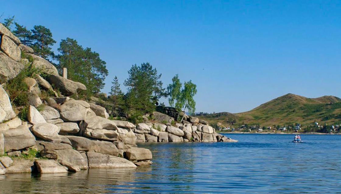
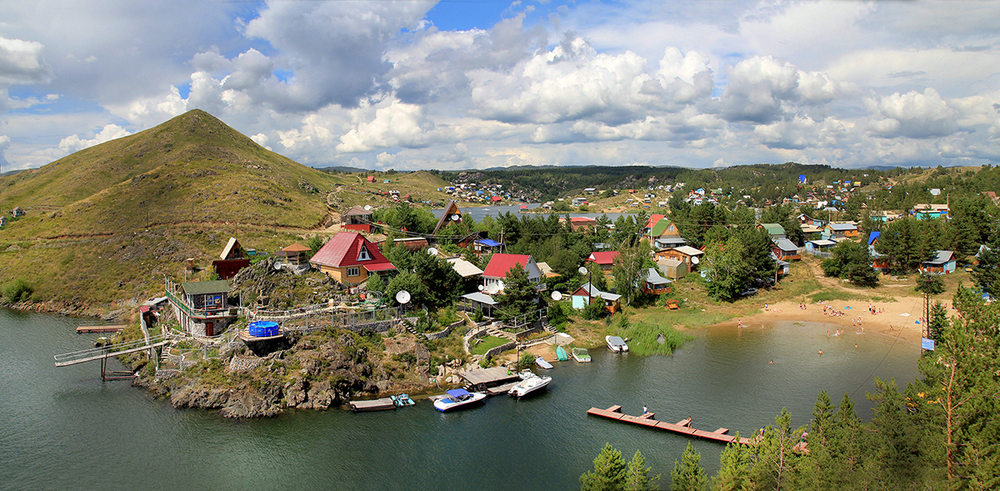
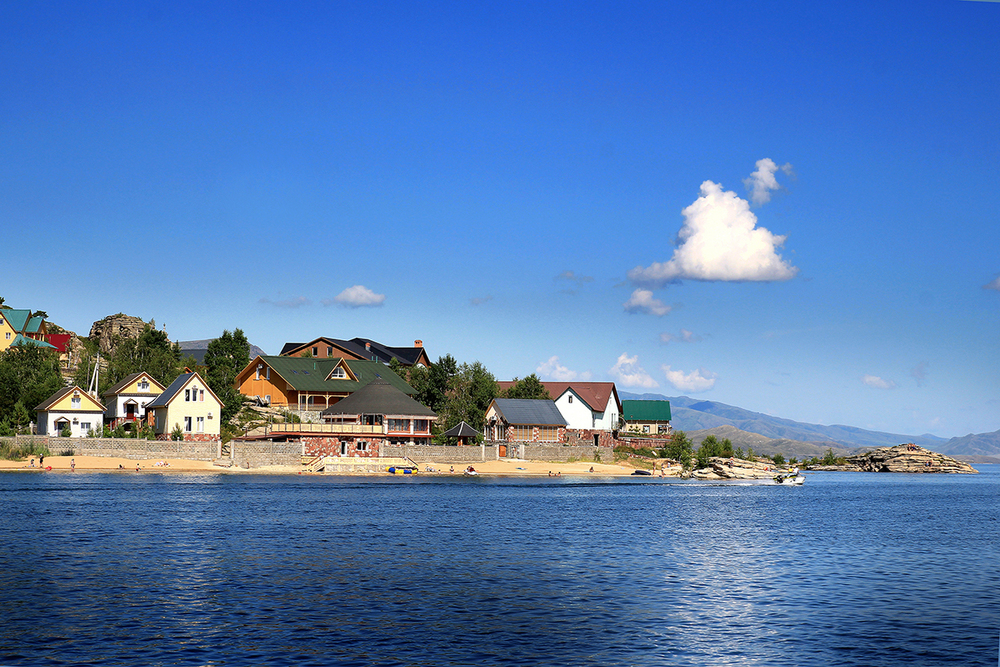
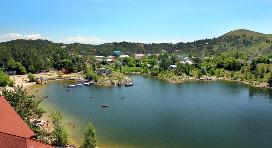
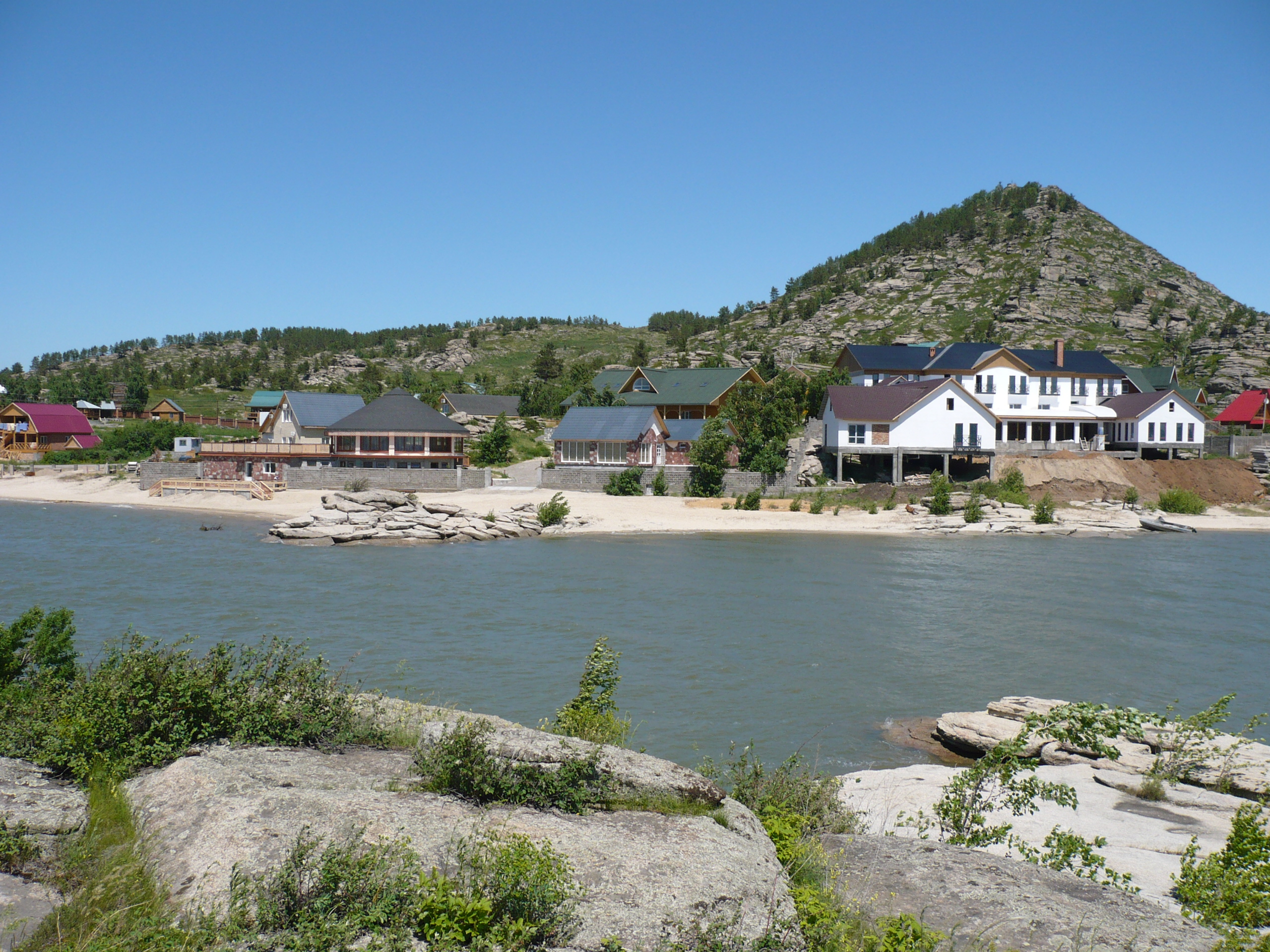
The reservoir towns of Bukhtarma, Serebryansk, and Zaysан provide the primary visitor infrastructure: guesthouses, boat rental, fishing licenses, and local guides for the water and mountain activities. There is no central "visitor center" for the reservoir as a whole — the area is managed across several municipalities, and information and services are distributed accordingly.
Access to the reservoir surface is primarily by boat; the dramatic cliff and island formations that make the landscape remarkable are best seen from the water. Boat rental is available in the main reservoir towns by negotiation with local operators. Agree on price, duration, and any guide services before departure.
Mobile Coverage and Navigation
Mobile signal is reliable in the reservoir towns and along the main road. In the more remote sections of the reservoir — the mountain inlets and the islands — coverage drops. Download offline maps before departure. The reservoir is large enough that getting disoriented on the water without navigation is a genuine concern; stay close to the main shore unless you have GPS and know the route.
Best Time
June through September is the main visitor season. July and August are warmest for water activities. September brings the first Altai autumn color and significantly fewer visitors. Spring and early summer are popular for fishing. Winter on the reservoir is cold but spectacular — the frozen surface and the snow-covered Altai backdrop are a different experience entirely, for those equipped for it.
5+ Specific Activities
What to Do at Bukhtarma Reservoir
Fisherman Rashid Bekturov has been working the Bukhtarma waters since his father brought him out on the boat as a child. He knows which inlets hold perch in early summer, where the pike come up in the shallower sections, and which section of the Altai shoreline catches the last light on September evenings in a way that makes the cliffs look like they're burning. "People come here to do things," he says. "Fishing, boating, hiking. But the best thing you can do here is just look at it. It's that big."
Boat Trip on the Reservoir
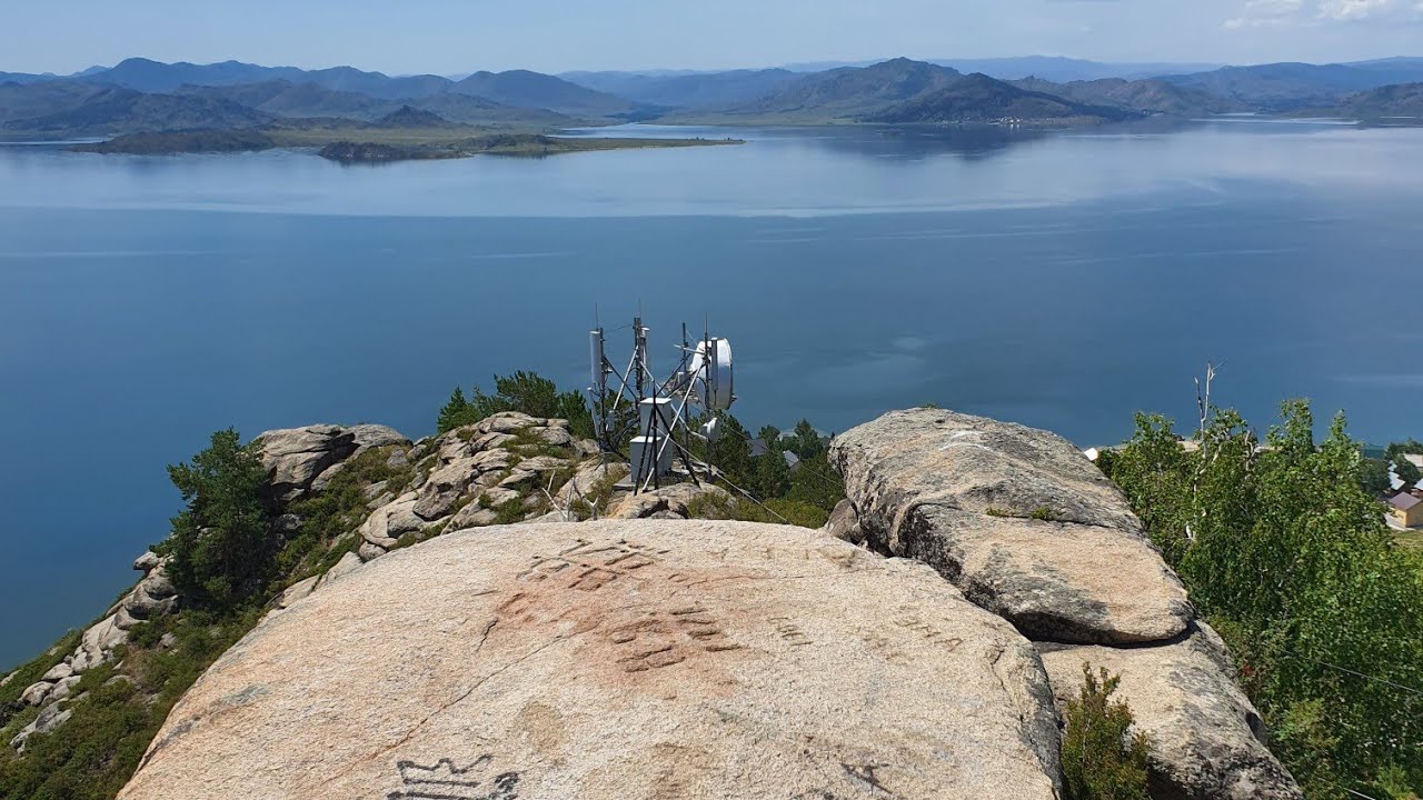
The scale of Bukhtarma is genuinely hard to communicate from the shore. The reservoir is nearly 500 kilometers long and up to 20 kilometers wide in sections, ringed by Altai mountain cliffs that rise directly from the waterline. Renting a boat and spending several hours on the water — moving between the inlets, passing the islands formed from the drowned valley topography, seeing the mountain walls from the water's surface — is the experience that defines Bukhtarma. Negotiate boat rental with operators in Bukhtarma town or Serebryansk; agree on price and duration before departure.
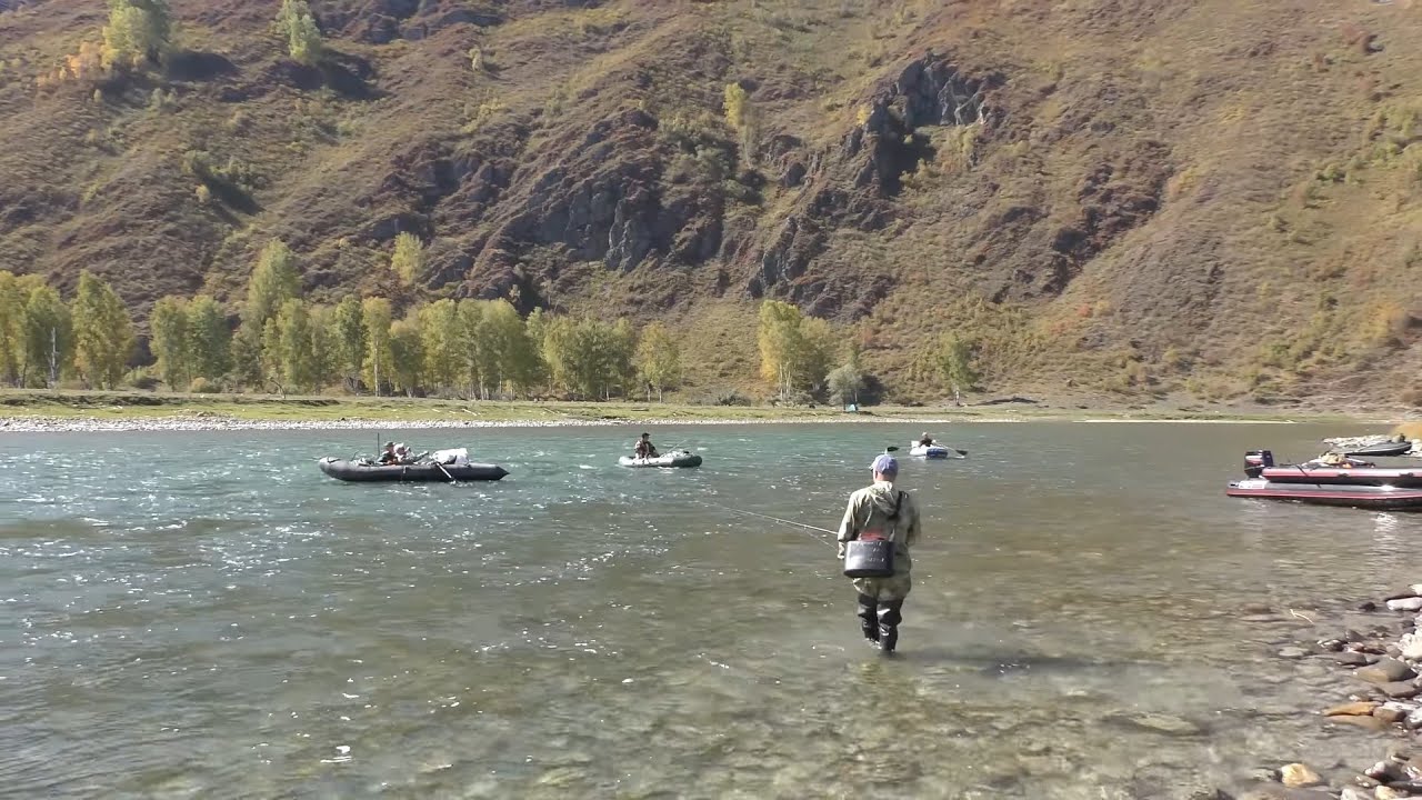
Fishing
The reservoir is among the best fishing locations in Kazakhstan. The deep, cold water supports populations of taimen, pike, perch, ide, and other freshwater species. Fishing requires a license available from local operators or the regional fisheries office. Local guides who know the productive sections and the seasonal patterns are worth hiring if you're serious about results; the reservoir is too large to navigate productively without local knowledge.
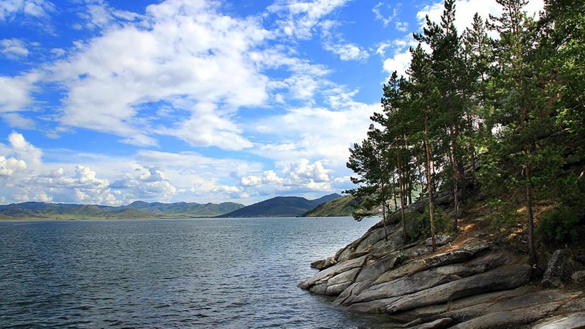
Hiking in the Altai Foothills
The mountains rising above the reservoir's southern shore include trail networks accessing Altai forest, alpine meadows, and elevated viewpoints over the water. The trails range from day hikes accessible from the reservoir towns to multi-day routes into the Katun-Uby Ridges and the South Altai. A local guide is recommended for anything beyond the established day-hike trails; the Altai backcountry requires navigation skills and preparation for rapid weather changes.
Photography: Golden Hour on the Cliffs
The limestone and granite cliffs on the reservoir's southern and eastern shores catch the late afternoon and evening sun at an angle that turns the rock face warm orange and gold. From a boat positioned in the middle of the reservoir at golden hour, looking toward the lit cliff face with the blue water below and the dark forest above — this is the image that Bukhtarma photographers specifically plan for. A standard telephoto lens brings the cliff detail close; a wide angle captures the scale.
Winter Ice
For visitors equipped for cold, Bukhtarma in January and February is a different world: the reservoir partially frozen, the Altai peaks snow-covered, the valley roads quiet. Ice fishing is practiced locally. The winter landscape photography is exceptional for those with the gear and the tolerance for temperatures below –25°C.
Sustainability & Responsible Travel
Visiting Bukhtarma Responsibly
Biologist Natalya Kozlova has been monitoring the fish populations of Bukhtarma Reservoir for fifteen years. Her concern is direct: the taimen, Kazakhstan's largest freshwater fish and of the largest in the world, is under pressure in the Bukhtarma system from a combination of overfishing, habitat disruption, and the long-term temperature changes affecting the Irtysh watershed. "The reservoir is big enough to absorb a lot," she says. "But not everything."
Fishing Ethics
If you're fishing at Bukhtarma, obtain the required license and follow the catch regulations. Taimen in particular are under protection rules — the size limits and catch-and-release requirements for this species exist because the population cannot sustain unlimited take. Practice catch-and-release where the rules require it, and voluntarily where they don't. The fish were here before the dam; they should be here after your visit.
Boat Waste
The reservoir is large but effectively enclosed. Fuel waste, sewage, and litter disposed of from boats accumulate in the water body with no natural exit. Use the waste disposal facilities at the reservoir towns before and after water activities. Don't dispose of anything in the water.
Supporting the Local Communities
The towns of Bukhtarma and Serebryansk, and the smaller settlements around the reservoir's shores, depend heavily on the tourism and recreation economy generated by the water. Hiring local boat operators, fishing guides, and guesthouse owners directly — rather than booking through national aggregators — routes more of the economic value to the communities who live with the reservoir year-round.
The Drowned Landscape
The reservoir's history includes the communities submerged by its creation. For visitors who are moved to acknowledge this: the descendants of those communities still live in the region. Listening to the local history with respect, and understanding the reservoir as a complex inheritance rather than simply a beautiful destination, is the most substantive form of responsible tourism that Bukhtarma offers.
Practical Tips for travelers
Practical Notes for Visiting Bukhtarma
When to Go
June through September is the primary window for water activities. July and August are warmest for swimming and boating, but also the busiest weeks, with Kazakhstani families arriving from Ust-Kamenogorsk and Semey in significant numbers for summer recreation. Early June and September offer similar access with less crowding. The Altai autumn arrives noticeably earlier at elevation than on the steppe — the upper mountain slopes begin to turn in mid-August, and by September the full autumn color display is beginning.
What to Wear
The weather can change rapidly in the Altai region — a warm morning on the reservoir can turn into a cold, wet afternoon as weather moves off the mountains. Pack a waterproof layer even for summer day trips. On the water, the wind across the reservoir surface cools temperatures below what the shore air suggests; a windproof jacket is useful even in July. Sun protection is essential — the water surface reflects UV significantly.
Booking
Boat rental and guided fishing trips are best arranged in advance, particularly in July and August when local operators' calendars fill. Guesthouse accommodation in the reservoir towns has increased in recent years but can still be tight on summer weekends. Contact accommodation providers directly (through local recommendation or the regional tourism portal) rather than through national booking platforms that may not accurately reflect current availability.
Water Safety
The reservoir is deep, the water is cold, and the Altai weather can generate waves quickly in a body of water this large. Don't swim alone in unfamiliar sections. Life jackets are required equipment on rental boats; confirm this before departure. Tell someone where you're going if you're taking a boat into the more remote inlets. Emergency assistance on the reservoir is not rapid.
Fishing Licenses
Required. Available from local operators and the regional fisheries office in Ust-Kamenogorsk. Catch limits and seasonal restrictions apply — particularly for taimen, which are protected. Fishing without a license carries fines. The regulations are enforced by water patrol during the peak season.
History & Discovery
Engineering, Displacement, and the Sea They Made
The Bukhtarma Hydroelectric Power Plant was completed in 1960, part of the massive Soviet industrial program that transformed the Irtysh River system in the second half of the 20th century. The dam is a significant piece of infrastructure by any measure: the reservoir it created covers over 5,500 square kilometers and holds more than 50 cubic kilometers of water — a volume that makes "Bukhtarma Sea" the colloquial description among East Kazakhstan residents entirely appropriate.
The engineering decision to build here was driven by the industrial geography of East Kazakhstan. The region's zinc, lead, and copper smelters at Ust-Kamenogorsk and Leninogorsk required enormous quantities of reliable electricity. The Irtysh River, descending from the Altai into the west Siberian plain, carried the hydraulic potential to provide it. The dam was the logical solution within the Soviet industrial framework.
What the framework did not weigh with equivalent attention was the human cost. The creation of the reservoir flooded dozens of villages in the Bukhtarma valley — Kazakhstani and Russian settler communities that had occupied the valley for generations. Families were relocated, cemeteries were submerged, agricultural land was lost. The dam's construction documentation records the relocation numbers; the records of what was lost in terms of community, cultural landscape, and accumulated local knowledge are less comprehensive.
The reservoir's subsequent role in the regional ecology has been complex. The creation of a deep, cold water body in the Altai foothills modified local microclimate, altered the aquatic ecosystem, and created habitat for fish populations — including the taimen — that have made Bukhtarma of Kazakhstan's most significant fisheries. The reservoir also provides flood control for the downstream Irtysh system and supplies municipal water to several East Kazakhstan cities.
Kazakhstan's independence did not reverse the engineering decisions made during the Soviet period, but it changed the terms on which those decisions are evaluated. The submerged communities belong to Kazakhstani history now, not Soviet administrative history. The reservoir that sits above them is a part of the national landscape — complex, significant, and worth understanding in its full context: a piece of infrastructure built at cost, producing benefits and carrying the weight of what it replaced.
The Experience
What It Feels Like to Be on the Bukhtarma
Rashid had been on the reservoir since before sunrise. His boat sat still in the inlet he uses for morning fishing, the engine off, the water surface flat and dark in the hour before the light came. Behind him the Altai cliffs rose several hundred meters from the waterline and disappeared into the cloud that still clung to the ridge. In front of him, the inlet opened the main body of the reservoir, which extended east as far as he could see — water and rock and mountain, no visible human infrastructure in any direction, the silence complete except for the occasional sound of a fish breaking the surface somewhere in the dark.
"People ask me what the reservoir is," he said. "I tell them it's a sea. They think I'm exaggerating. Then they see it."
The Bukhtarma is 500-plus kilometers of water in the Altai mountains, and the experience of being on it is qualitatively different from being on a smaller body of water. The scale changes the acoustics: sounds travel differently across that surface. It changes the weather: the reservoir generates its own microclimate, pulling fog from the mountain walls in the morning and building afternoon thermals that produce waves by 2 p.m. on summer days when the steppe beyond the mountains is clear. And it changes the sense of orientation: from the middle of the main channel, the mountains appear to float above the waterline, detached from the water, their reflections doubling the vertical space between sky and water surface.
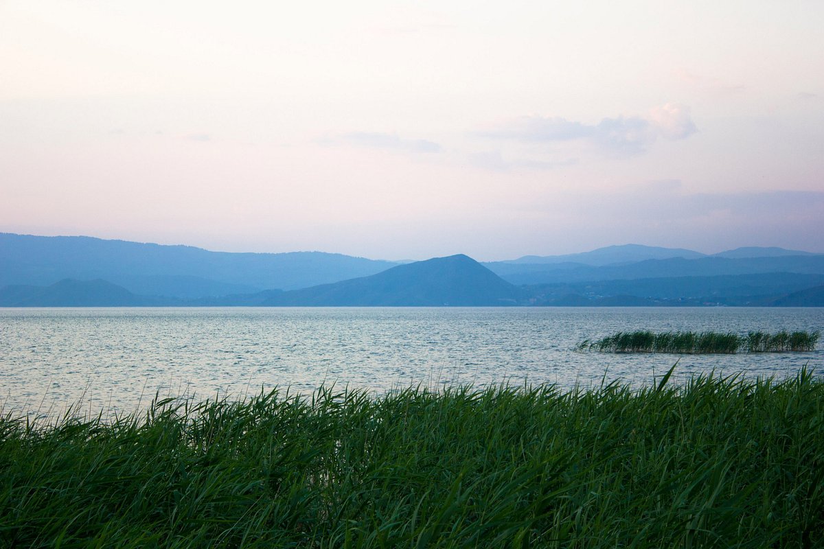
The smell is cold water, juniper from the shoreline, fish — the working smell of a place where the ecology is intact and active. The color changes through the day from the pre-dawn gray-black through a particular deep blue in the morning that shifts to a lighter turquoise when the sun is overhead and back to deep blue and orange as the afternoon progresses and the cliffs begin to catch the raking light.
Some visitors come to fish. Some come to hike the Altai trails above the shoreline. Some come simply to look at a body of water large enough that the horizon is genuinely the curve of the earth. All of them, sitting quietly in a boat somewhere on the inland sea of East Kazakhstan, tend toward the same long silence. The reservoir has that effect. It asks for it.
Key Facts
- Massive Scope
- Commonly called the 'Bukhtarma Sea,' it is one of the five largest man-made reservoirs in the world by surface area.
- Mountain Coast
- The reservoir is uniquely surrounded by the Altai mountains, offering a rare blend of maritime recreation and alpine hiking.
- Blue Energy
- The dam on the Irtysh River provides a vital source of renewable hydroelectric power for the entire East Kazakhstan region.
- Summer Retreat
- The 'Blue Bay' area features dozens of resorts and yacht clubs, serving as the primary summer destination for Ust-Kamenogorsk residents.
- Fishery Wealth
- The deep waters are rich in pike, perch, and sturgeon, supporting both professional and recreational fishing communities.
- Cinematic Pass
- The ferry crossing at Kurshum offers one of the most scenic boat journeys in the country, with views of the vast horizontal sky.
Photo Gallery

Embedded Video
Bukhtarma Reservoir
Loading map...Loading map...
FAQ
Have a question?
Ask and get answers in seconds!
Discussion 0
No comments yet. Start the conversation!
Leave a Reply