Atameken Map Kazakhstan
The City of Future. Futuristic architecture in the steppe.
Detailed History & Context
There is something quietly remarkable about a country choosing to represent itself to its own children through miniature. The Atameken complex — an outdoor map of Kazakhstan rendered at scale, with miniature versions of major landmarks, natural features, and historical sites positioned across a landscape that mirrors the country's actual geography — was built in Astana as an educational and cultural monument, and it functions as. But understanding what it represents requires understanding the history it's organizing.
Kazakhstan is the ninth-largest country on earth by land area: 2.7 million square kilometers of steppe, desert, mountain, forest, and river basin. For most of its history, this territory was managed not by fixed borders but by the seasonal movement of nomadic peoples — the Saka warrior cultures from the fifth century BCE, the Scythian successors, and ultimately the Kazakh Khanate, founded by Khans Janibek and Kerei in 1465, whose governance depended on an understanding of landscape that could not be reduced to a map.
The Russian annexation of Kazakh lands between 1731 and 1848 imposed administrative borders on a territory that had previously operated through different spatial logics. The Soviet period then reorganized the land further: collective farms replacing nomadic routes, new cities appearing on steppe that had previously seen seasonal encampments. The Asharshylyk of 1930–33, which killed between 1.5 and 2.3 million Kazakhs through Soviet collectivization policy, was partly a consequence of forcing nomadic people into fixed agricultural space that couldn't support their population.
Kazakhstani independence in 1991 restored sovereign control over this vast territory. The Atameken Map — built after the capital relocated to Astana — is expression of a newly independent state asserting its geographical identity: here is what we govern, here is where we come from, here is the scale of what independence means when the country in question is this large and this diverse. Standing at the map's edge and trying to comprehend 2.7 million square kilometers in miniature is, in its way, an act of national imagination.
Digital Logistics & Access
Getting There
The Atameken Map complex is located in Astana's Left Bank zone, approximately 15 minutes by taxi from the Baiterek monument. Yandex Taxi and InDriver both service the area reliably; rides from the central tourist zone cost 1,000–2,000 KZT. There is bus access via Astana's city transit network; check current routes via the 2GIS app.
Entry and Hours
Admission is charged; current ticket prices are typically in the 1,500–2,500 KZT range per adult, with reduced prices for children. The complex is open seasonally — primarily May through October, when the outdoor setting is accessible and comfortable. Winter visits are generally not possible as the outdoor map area is closed. Confirm current hours via the official Atameken website before planning your visit, as seasonal schedules can vary.
Getting Around
The outdoor map spans a significant area — visitors typically need 90 minutes to two hours to walk the full circuit and spend time at the major landmark installations. Comfortable walking shoes are required; the paths cover the equivalent of several kilometers across the grounds. A printed or digital map of the installation helps with orientation; the relative positions of Kazakhstan's regions are geographically accurate but may not be immediately legible without a reference.
Connectivity and Information
Public Wi-Fi is available in the visitor center and main covered areas. The outdoor installation has signage in Kazakh, Russian, and some English. For deeper context on specific landmarks represented in the miniature, the official Atameken app provides audio and visual guides to individual installations — download and charge your phone before visiting, as signal inside the open-air grounds is variable.
5+ Specific Activities
Walk the Whole Map
The Atameken Map's geographical layout mirrors Kazakhstan's actual proportions: the Caspian coast in the west, the Altai mountains in the east, the steppe in the center, the southern cities along the ancient Silk Road corridor. Walking the complete circuit — which takes about 90 minutes at a thoughtful pace — gives you a spatial understanding of Kazakhstan's scale and diversity that no amount of reading provides. Pay attention to the relative distances between regions. The country is larger than Western Europe.
Find Your Region of Interest
If you have specific places planned for your Kazakhstan journey, locating them on the Atameken Map before you visit adds a layer of orientation. Standing in miniature at the position of Baikonur Cosmodrome on the steppe, or at the Yasawi Mausoleum in the south, or at the Altai mountain region in the east, gives you a proprioceptive sense of where things are relative to each other — a sense that no digital map quite replicates.
Focus on the Miniature Landmark Models
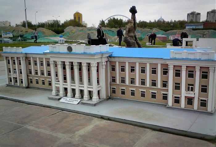
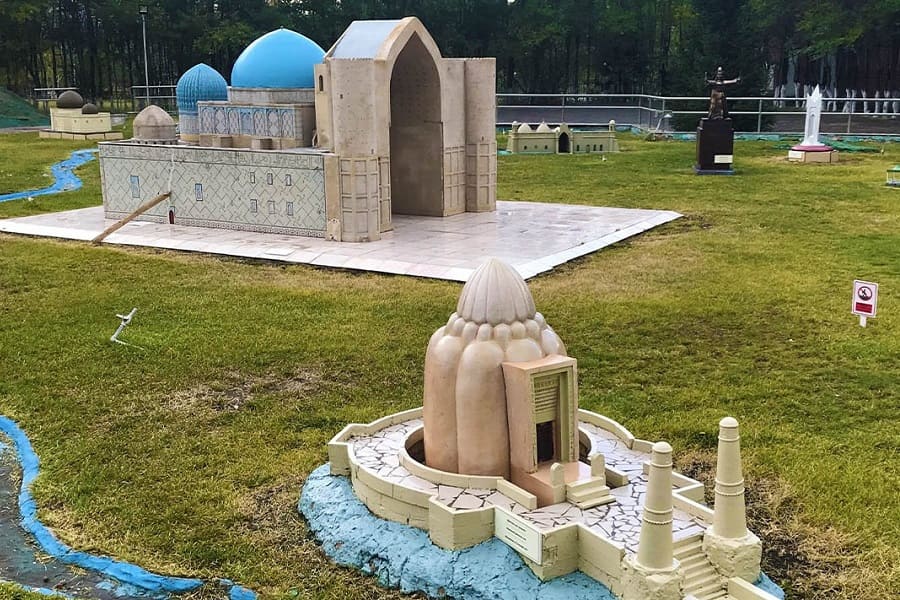
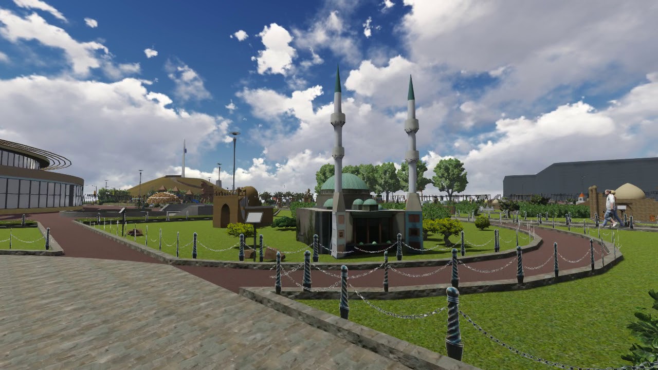
The installation's most intricate elements are the scale models of major architectural and natural landmarks: the Yasawi Mausoleum, the Baiterek, the Charyn Canyon formations, the Tian Shan peaks. These reward close examination. The craftsmanship of the better models is genuinely impressive — the detailing on the historical mausoleums in particular is executed at a level that implies respect for the originals.
Photograph at Golden Hour
The models cast interesting shadows in late afternoon light, and the full outdoor map creates long compositional lines when the sun is low. Photographers who arrive two hours before sunset will find conditions considerably more interesting than midday.
Bring Children
The Atameken Map was designed with children as of its primary audiences, and it works exceptionally well for that purpose. The miniature scale is intrinsically engaging for young visitors, the ground is safe and walkable, and the educational content — which regions produce what, where the major rivers run, how the country's landscape varies — lands naturally through exploration rather than instruction.
Sustainability & Responsible Travel
The Atameken Map's sustainability considerations are primarily about preservation of the installation itself and about using the site as an entry point to thinking about Kazakhstan's real geography.
Respecting the Installation
The scale models and landscaped features require maintenance. The most basic visitor contribution is not touching or climbing on the miniature structures — the models are scaled and positioned for viewing, not for contact, and the accumulated effect of thousands of hands does measurable damage over time. Stay on marked paths. Don't let children climb the model structures, regardless of what appears to be happening around you.
The Broader Geography
The Atameken Map represents a country whose real landscapes face genuine environmental pressures: the Aral Sea ecological crisis (the southern shore of the Aral appears in the map's western section, now representing a catastrophically diminished body of water); the desertification pressures on the steppe; the industrial impacts on the Caspian coast; the glacial retreat in the Tian Shan. The miniature gives you a useful mental model of Kazakhstan's geography. What you do with that model — whether it motivates genuine curiosity about the real places represented — is the sustainable travel question this site poses.
Entry Fee Distribution
A portion of admission revenues supports the maintenance of the installation and associated educational programming for Kazakhstani school groups, which constitute a significant portion of the visitor base. Coming during a school visit period and observing Kazakhstani children engaging with the representation of their own country is, in itself, worth something — a reminder that this installation serves a primary purpose that has nothing to do with international tourism.
Use Digital Rather Than Paper
The official Atameken app provides maps and guides without requiring printed materials. Download it before your visit.
Practical Tips for travelers
Best Time to Visit
The complex is fully operational May through October — the outdoor nature of the installation makes winter visits impractical. Within the open season, mornings (before noon) are quieter than afternoons, and weekdays see fewer visitors than weekends. School groups visit frequently on weekday mornings during the academic year; if you prefer the installation to yourself, mid-week afternoons or early morning are the best windows.
The golden hour before sunset (from about 5pm in summer) creates the most photogenic lighting conditions for the miniature models and the full map view.
Clothing and Physical Preparation
The Atameken complex is an outdoor walking site. Comfortable shoes are required — the paths cover several kilometers total. Sun protection is essential in summer: Astana's steppe location means full sun exposure across much of the map area, and sunburn happens faster than most visitors expect. Bring water. In spring and autumn, bring a windproof layer — Astana's steppe wind doesn't pause for sightseeing.
Booking and Entry
Walk-in entry is available during operating hours. For guided tours — which provide explanatory context for the historical and geographical content of the installation — advance booking through the official website is recommended, particularly for weekend visits. The guided experience takes approximately two hours and is available in Kazakh, Russian, and often English; confirm language availability when booking.
Combining with Other Astana Sites
The Atameken Map is most logically combined with other Left Bank attractions — the Baiterek observation deck, the National Museum, or the EXPO-2017 Legacy complex. Allow a full day for the combination if you plan to visit the National Museum thoroughly.
Architecture & History
The Atameken Ethno-Memorial Complex was inaugurated in the early 2000s — in the first decade after Kazakhstan's capital moved to Astana from Almaty in 1997. The timing was not incidental. A newly independent country, building a new capital, had specific reasons to invest in a monument that mapped the entire nation at walkable scale: to assert the scope of what independence meant, to visualize the geography that Soviet administration had organized but Kazakh identity had always understood differently, and to provide Kazakhstani children with a physical encounter with their country's dimensions.
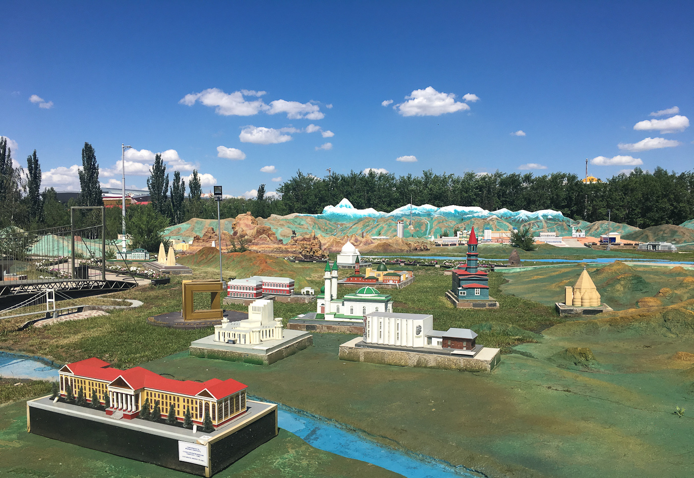
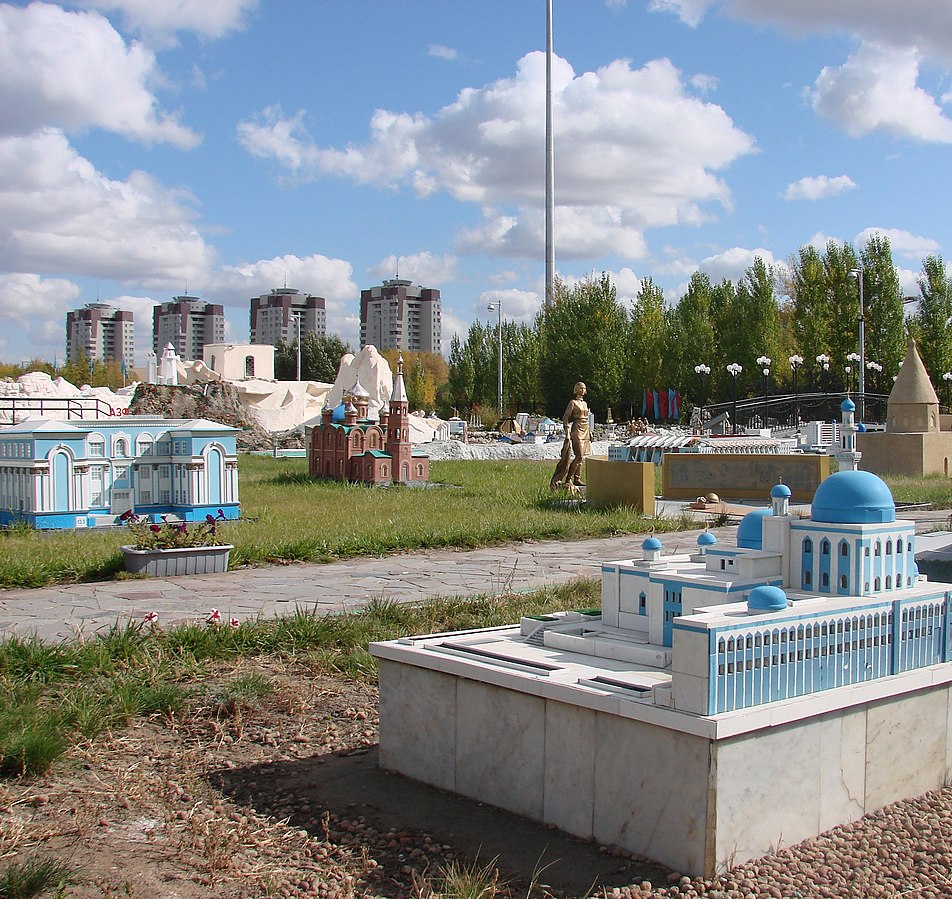
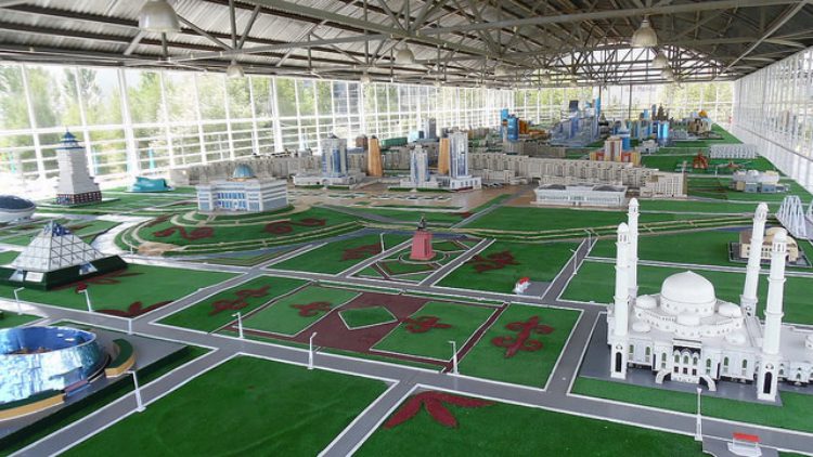
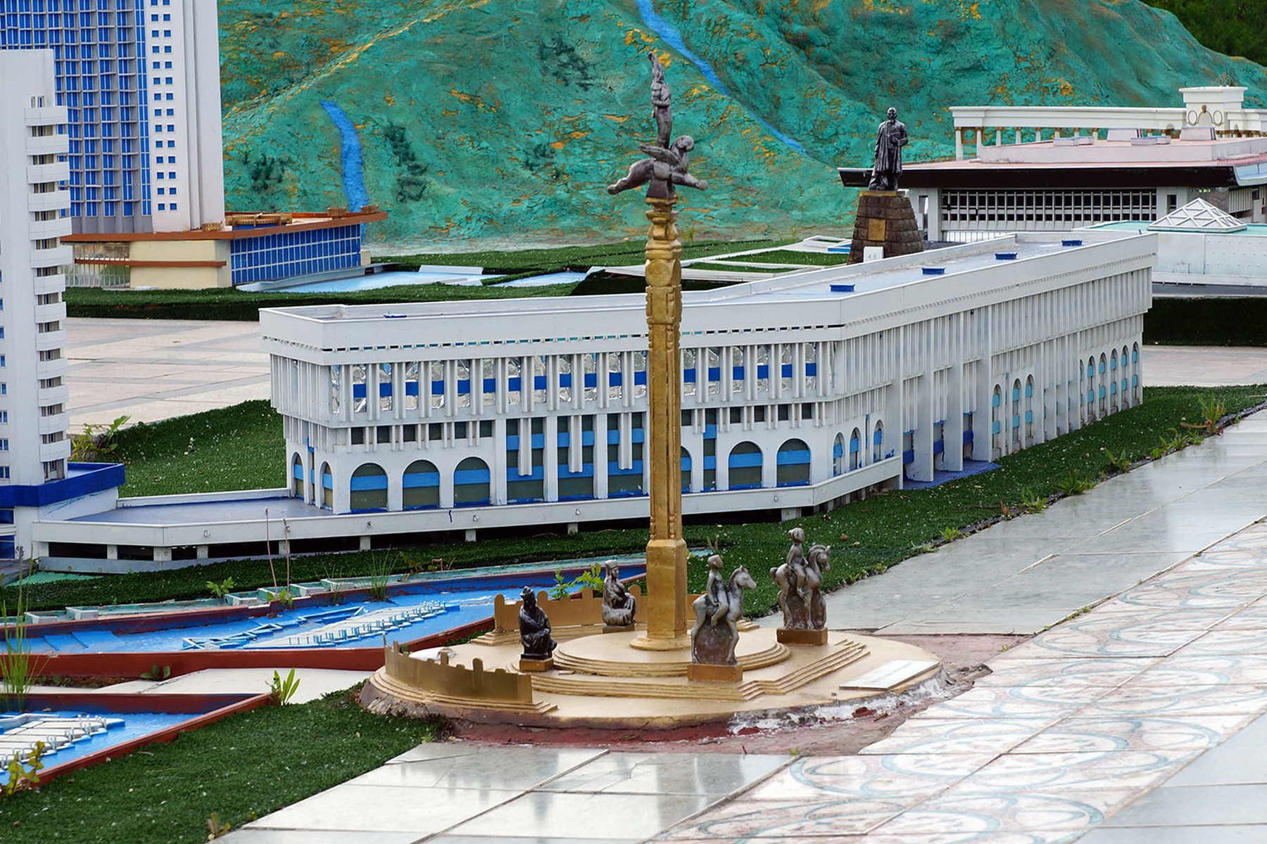
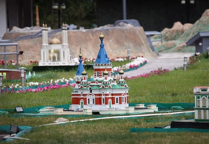
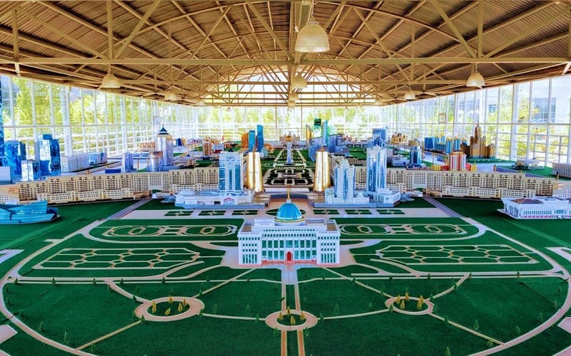
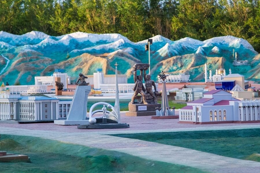
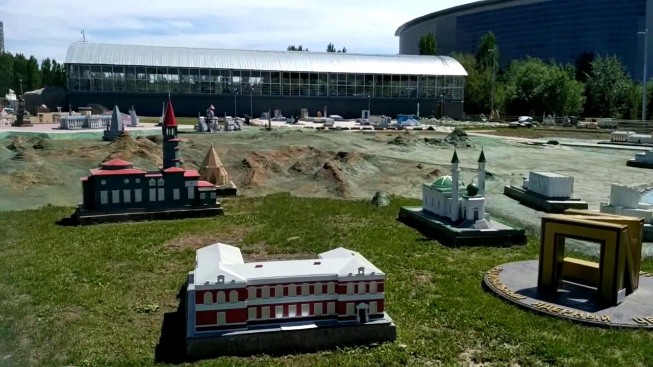
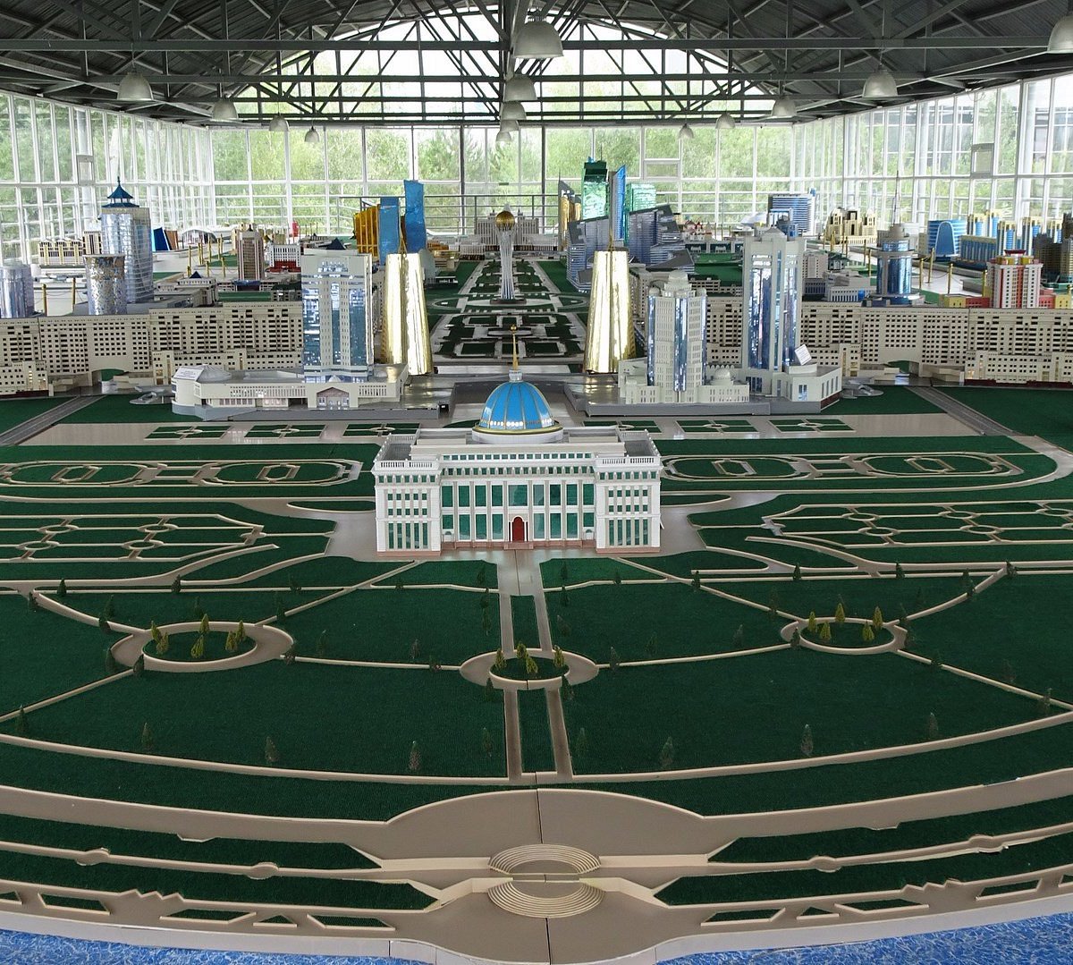
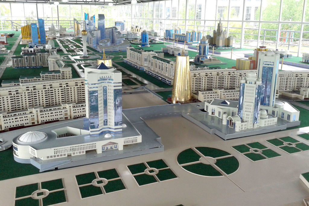
The "map" concept is both simpler and more complex than it sounds. The complex covers approximately 1.7 hectares of Astana's Left Bank, within which Kazakhstan's geographic footprint — 2.7 million square kilometers — is rendered at roughly 1:7,000 scale. The country's topography is modeled: the Caspian depression in the west, the steppe plateau across the center, the Tian Shan and Altai mountain systems in the south and east. Within this topographic base, 200-plus scale models of major architectural monuments, natural landmarks, and historically significant sites are positioned at their actual geographic coordinates.
The architectural approach draws on the ethno-memorial complex tradition — a form of outdoor cultural monument that Central Asian countries have developed as a way of representing national heritage through spatial experience rather than static display. The Atameken complex extends this tradition by integrating geographic accuracy with cultural representation: the miniature Yasawi Mausoleum sits at the complex's southwest as the Turkistan region sits in Kazakhstan's south; the Baiterek appears centrally as Astana occupies the country's geographic core.
The craftsmanship of individual models varies. The historical monuments — the Yasawi Mausoleum, the Bayterek, the Medeu ice rink complex — are executed with genuine attention to architectural detail. The natural features — the Charyn Canyon formations, the Tian Shan peaks — are more impressionistic, representing character rather than literal accuracy. The effect of the whole is cumulative: individual elements read differently than the full circuit, which builds a sense of territorial scale that no single model can achieve.
The landscape maintenance required to keep 1.7 hectares of topographically varied outdoor installation functional is significant. The complex's upkeep budget includes horticultural management of the planted areas between the models, seasonal repairs to the scale structures exposed to Astana's extreme climate, and path maintenance for the visitor circuit. Entry fees fund a portion of this; the Astana city government supplements the remainder as part of the complex's cultural monument status.
Miniature Kazakhstan
A child takes nine steps between the Caspian coast and the Altai mountains. This compression — the entire west-to-east span of Kazakhstan, roughly 3,000 kilometers in real space, condensed to a few minutes of walking — is the Atameken Map's central experience, and it works on adults as much as on children.
The country you walk across is geographically accurate in its proportions. The Caspian depression in the far west sits lower than the surrounding steppe — the depression is real, rendered at scale. The central steppe plateau is flat. The southern mountain zone rises toward the Tian Shan range, with the Charyn Canyon's distinctive red-rock formations represented in miniature at roughly the correct position relative to Almaty. The Altai mountains in the northeast have a different geological character from the Tian Shan — the models acknowledge this, the granite and pine country of the Altai looking different from the limestone karst of the south.
Between these natural features, 200-plus scale models of Kazakhstan's major historical and architectural landmarks are positioned at their actual geographic coordinates. You pass the golden dome of the Yasawi Mausoleum in the south before reaching the cosmological symbolism of the Baiterek in the center. You see the Baikonur Cosmodrome in the steppe west of center, where it actually is. You find the Medeu skating rink in the Almaty foothills, where it has been since 1972.
The information density of this map — everything you could see and do and understand about this country, concentrated into 1.7 hectares — is both useful and faintly melancholy. It's an argument for actually going to the places it represents.
Miniature World
You walk through the whole country in fifteen minutes, if you're moving quickly. If you slow down and actually look at the miniature worlds underfoot and beside the path, the same distance takes two hours and still feels abbreviated.
The Atameken Map occupies roughly 1.7 hectares — about the size of two and a half football pitches — within which Kazakhstan's 2.7 million square kilometers are rendered in compressed form. The Caspian Sea in the west is an actual shallow pool, its water level maintained to represent the Caspian's historical fluctuations (which are themselves a major ecological issue — the model's shoreline has required periodic adjustment as the real sea's level has changed). The Aral Sea, in the south-central section, is a smaller and more tragic body of water in the model than it was, accurately representing of the twentieth century's most catastrophic ecological disasters.
The major cities appear as skyline silhouettes: Almaty's mountain backdrop rendered in miniature, Astana's Left Bank skyline in recognizable form. The Baikonur Cosmodrome's launch structures appear at roughly the correct relative position in the steppe. The ancient Silk Road cities — Turkistan with its Yasawi Mausoleum, Shymkent, Taraz — cluster in the south as they did in history.
Industrial sites are represented alongside natural and cultural landmarks: the Tengiz oil field in the western steppe, the steelworks of Temirtau in the central industrial zone. The map doesn't sanitize the economy into natural beauty and heritage; it includes the working parts.
Stand at the center of the map — roughly where Astana is in real geography — and look in all directions. The country is incomprehensibly large and you are, briefly, at its heart.
The Experience
Asel brings her four-year-old daughter to Atameken a year. The first time was when Aizhan was barely walking, carried in a sling past the miniature versions of places Asel had grown up hearing about — the Yasawi Mausoleum that her grandmother had visited on pilgrimage, the Charyn Canyon that her father had described but never taken her to, the Baikonur Cosmodrome that she associated with Soviet-era state pride and wondered what to make of as an independent Kazakhstani adult. "She doesn't understand it yet," Asel says. "But she will. I'm planting something."
This is what the Atameken Map is for, and why its educational and tourist functions are inseparable. The experience of walking across the compressed geography of your own country — of placing yourself at the center of a 2.7-million-square-kilometer landscape that has been made legible at human scale — is different depending on whether you're a Kazakhstani child encountering your homeland's dimensions for the first time, a Kazakhstani adult revisiting a monument of national identity, or an international visitor trying to understand a country you previously knew from a map application.
For international visitors in particular, the Atameken Map performs a function that nothing else in Astana quite matches: it gives Kazakhstan a shape. Not an abstraction on a globe — a physical, walkable, three-dimensional shape that includes the Caspian coast and the Altai peaks and the Silk Road cities and the industrial steppe and the mountain glaciers all in afternoon. The model simplifies, necessarily. But the simplification reveals something that no single site visit or travel article can provide: the sense that Kazakhstan is not a collection of separate destinations but a coherent country with a particular geography, a particular history, and a particular future that is still being built.
Walk it slowly. The models are better than they first appear. So is the country they represent.
Key Facts
- Miniature Republic
- Atameken is a unique open-air museum where the entire geography and architecture of Kazakhstan are presented in a 1:200 scale.
- Cultural Anthology
- Visitors can 'walk' across the entire nation in just two hours, viewing miniatures of everything from the Caspian Sea to the Altai Peaks.
- Historical Detail
- Every major mosque, stadium, and palace in the country is faithfully recreated with incredible attention to architectural detail.
- Educational Route
- The museum is the primary destination for school trips, providing students with a visceral sense of national identity and geographic scale.
- Interactive Grid
- Recently, the park features AR layers where visitors can see 'life' inside the miniatures through their mobile devices.
- Social Hub
- Located in the central park zone, the museum is surrounded by family attractions, making it a perfect weekend destination for locals.
Photo Gallery
Embedded Video
Atameken Map Kazakhstan
Loading map...Loading map...
FAQ
Have a question?
Ask and get answers in seconds!
Discussion 0
No comments yet. Start the conversation!
Leave a Reply