Tian Shan: The Celestial Mountains
The massive mountain system that forms the backbone of Central Asia. A paradise for trekkers and climbers.
Essential Profile
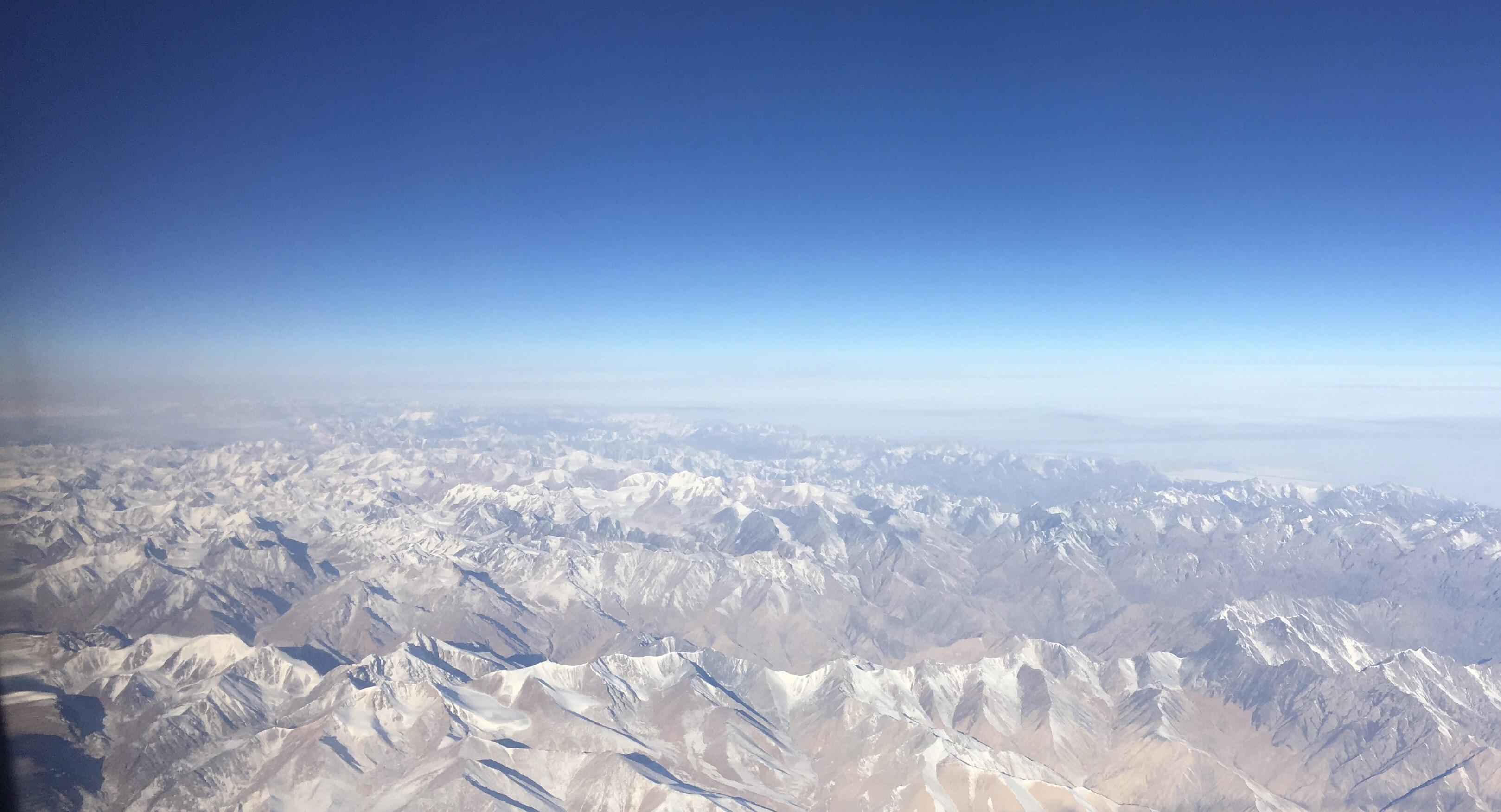
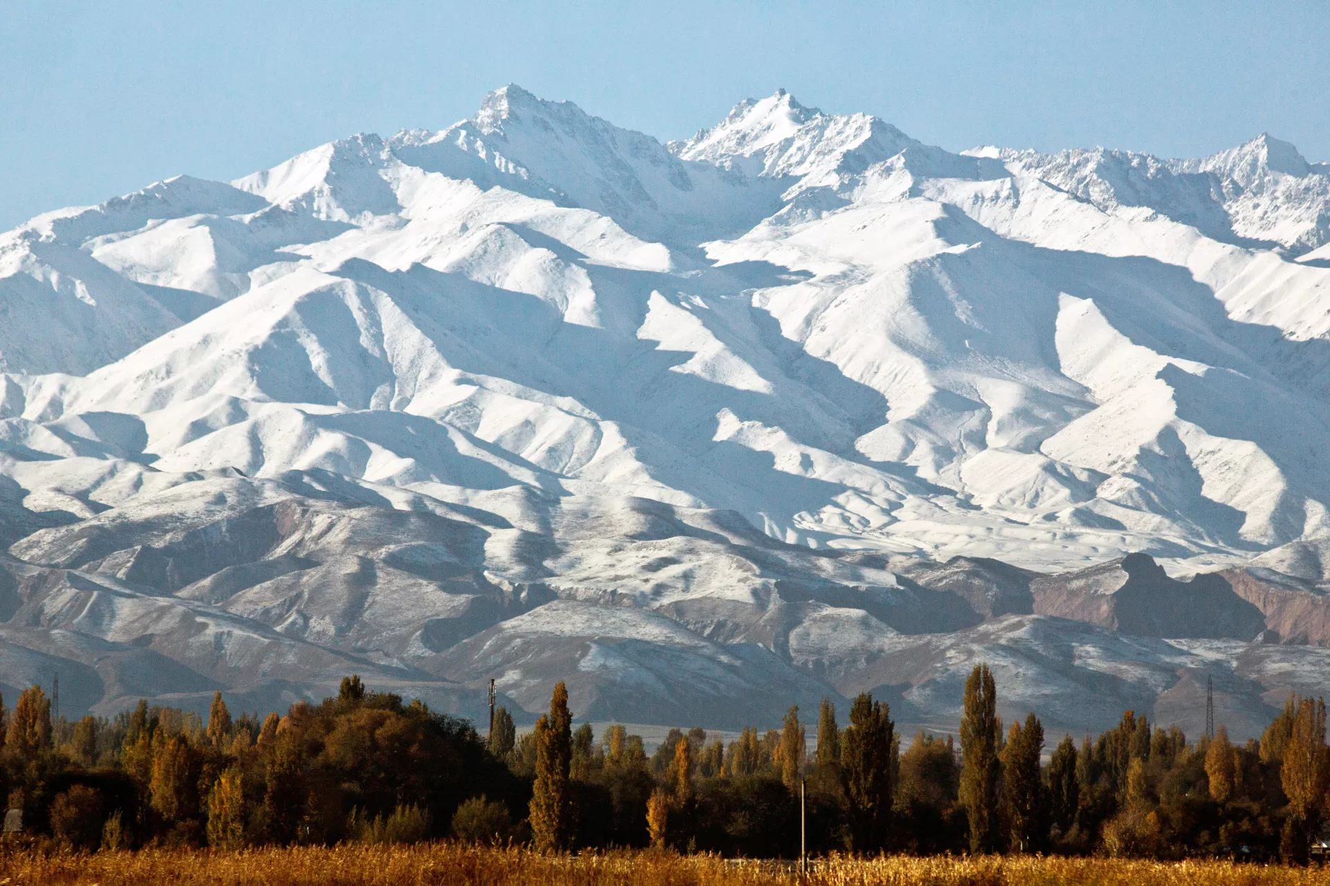
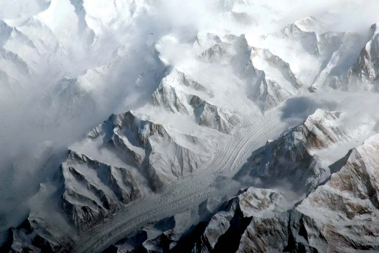
The Tian Shan — Celestial Mountains in Chinese, Tengri Tau in Kazakh — extends over 2,500 kilometres across Central Asia, crossing Kazakhstan, Kyrgyzstan, Tajikistan, and western China in a chain of ranges that defines the geography of the entire region. At its highest points in the central massif, the system reaches above 7,400 metres: Khan Tengri at 7,010 metres and Jengish Chokusu (Pobeda Peak) at 7,439 are the two highest summits and among the most technically demanding mountains on Earth.
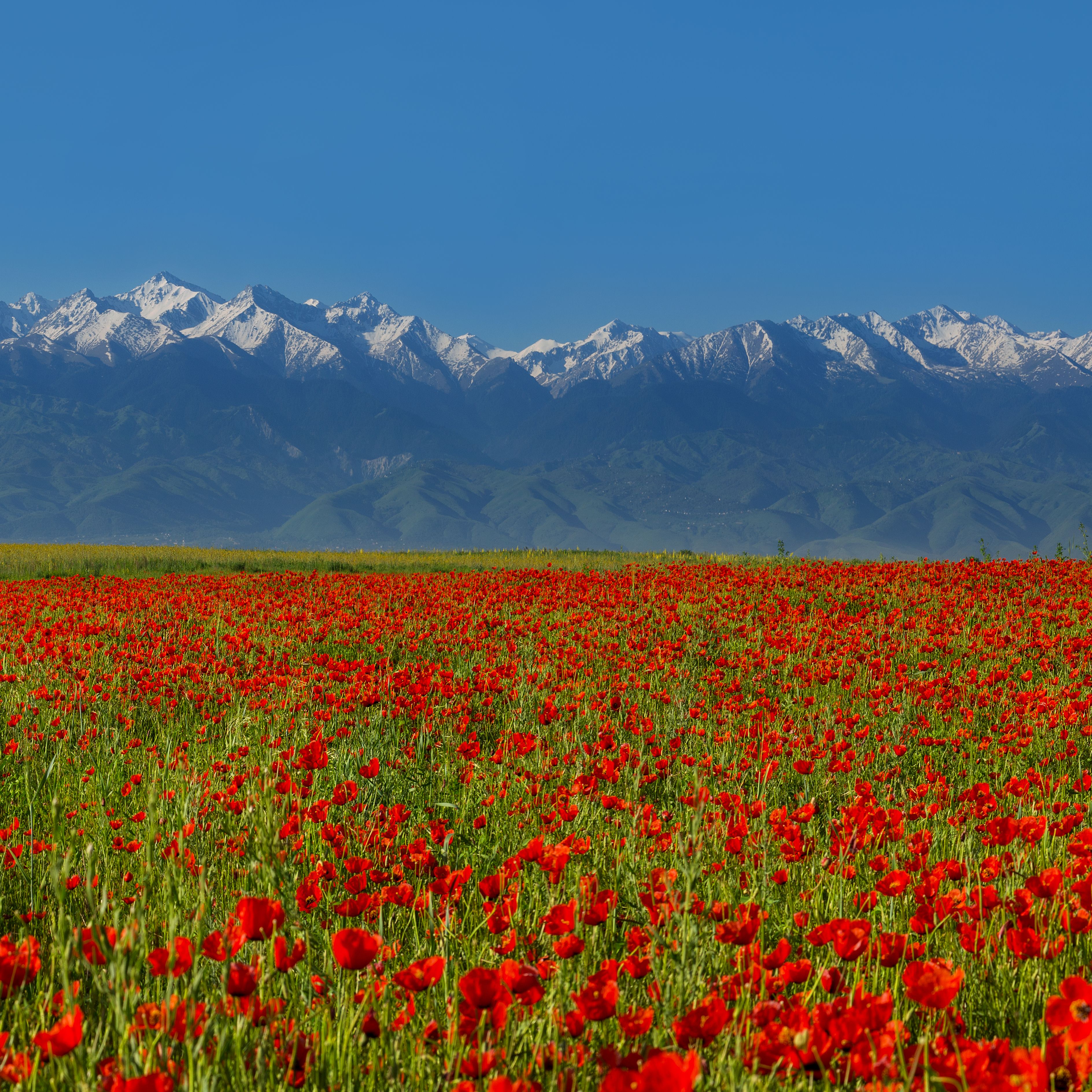
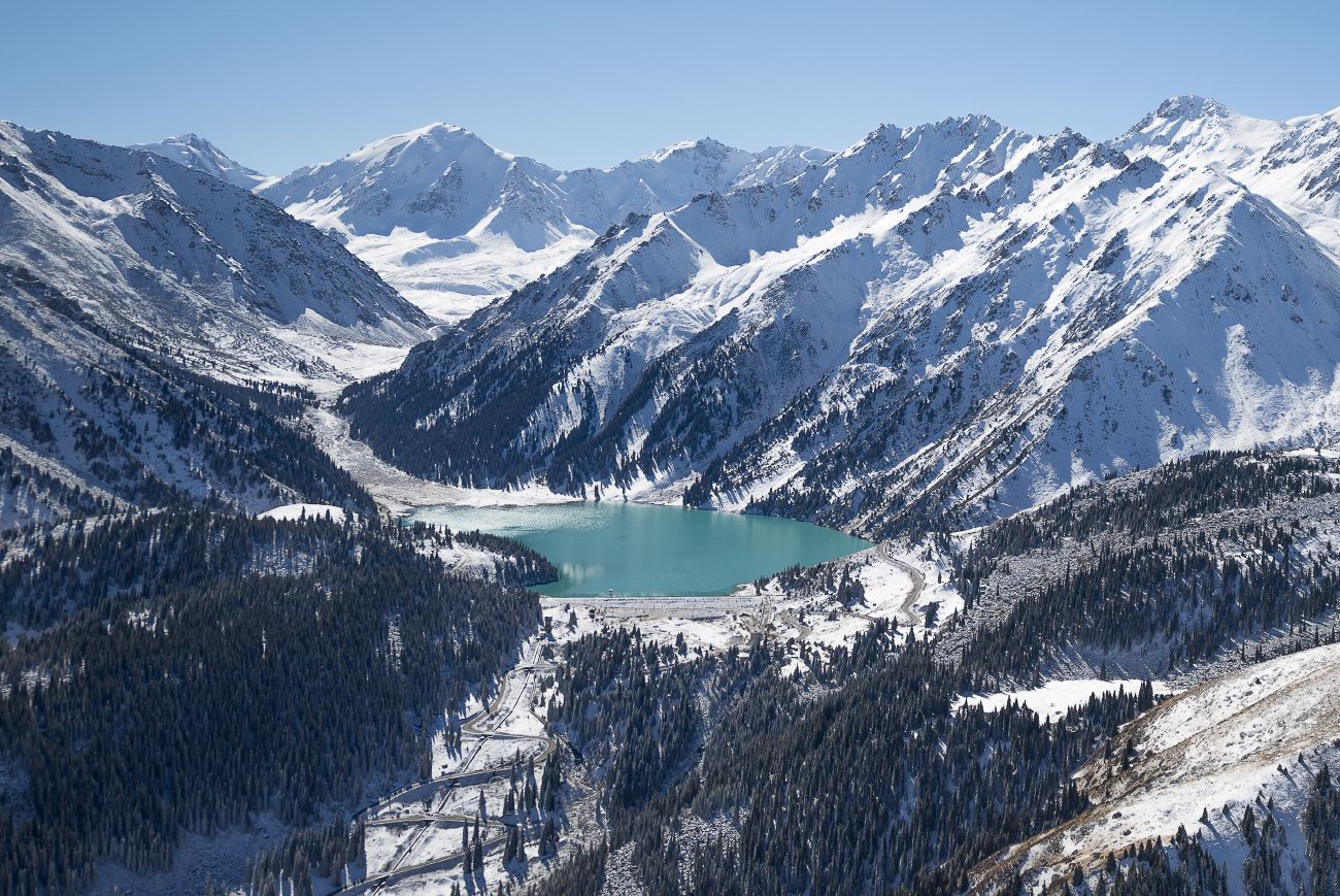
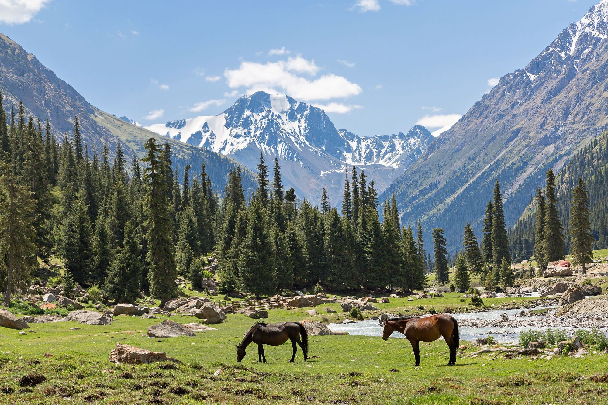
For visitors to Almaty, the Tian Shan is not an abstraction. The Trans-Ili Alatau, the northern spur of the system, provides the city's southern wall — the range visible at the end of every north-south street, white-capped for most of the year, rising from the steppe to over 4,000 metres within 30 kilometres of the city centre. The glaciers in that range feed the rivers that water Almaty. The forests on its slopes filter the air and hold the soil. The Ile-Alatau National Park that protects the foothills is of the city's fundamental assets.
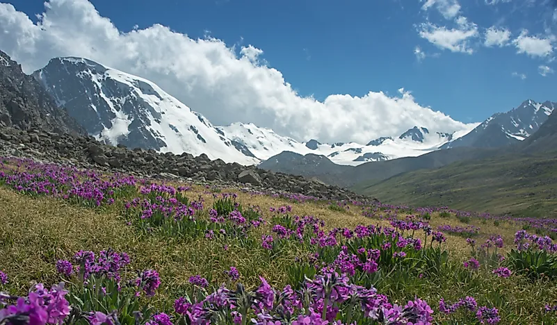
The western Tian Shan is a UNESCO World Heritage site, recognised for ecosystems that include the wild apple and walnut forests that gave the world its domestic fruit tree varieties. The wild apple (Malus sieversii) grows in the mountain forests of the Almaty region; Alma-Ata, the city's old Kazakh name, means "father of apples."
The range is a living system in change. Its glaciers are retreating at measurable rates, a transformation that will alter the water cycle of Central Asia over coming decades.
The ‘Wow-Factor’
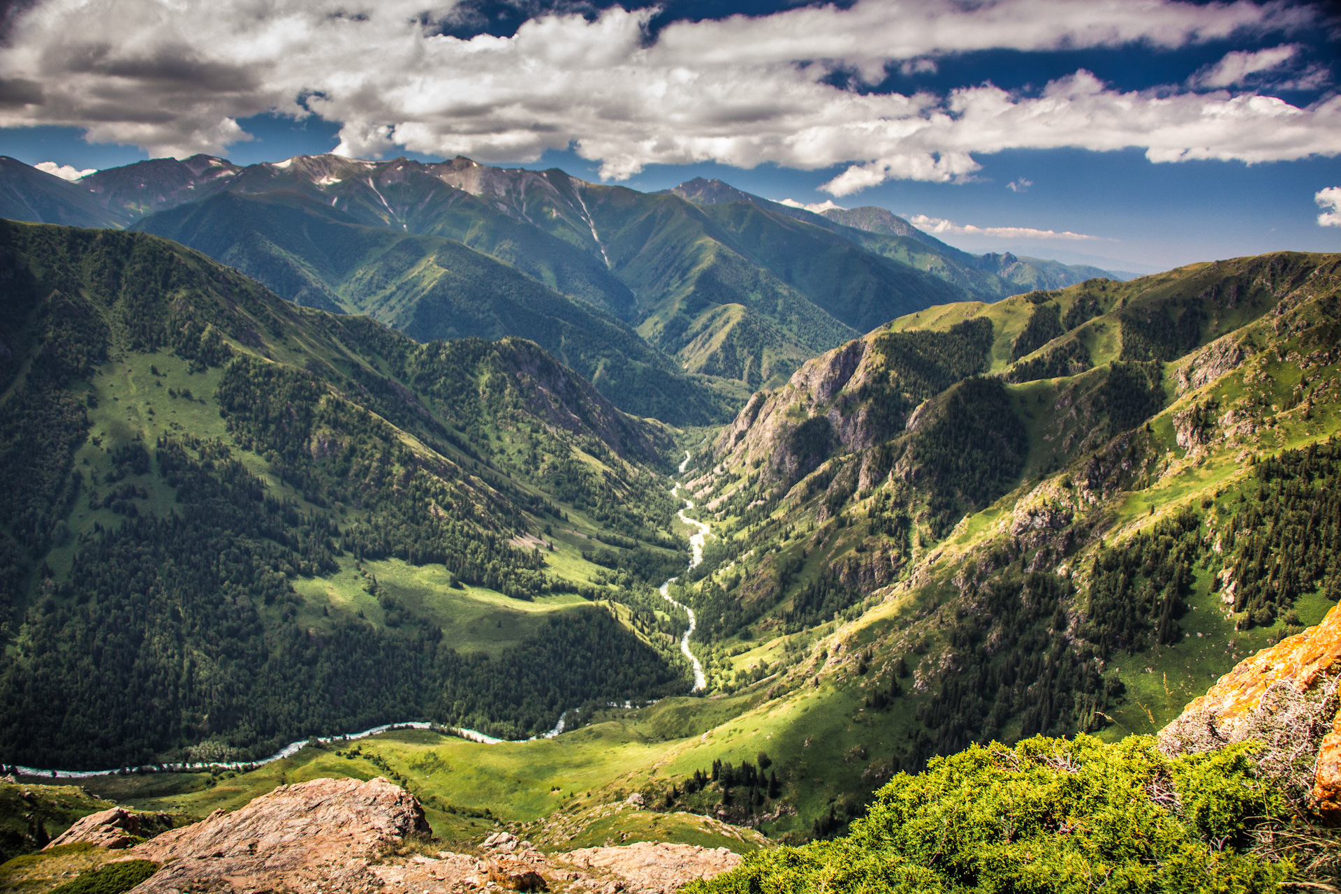
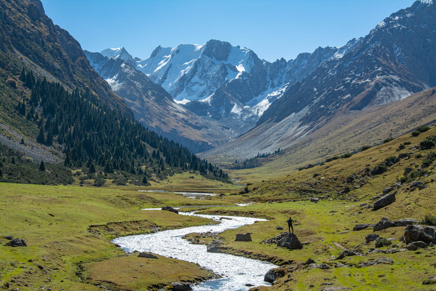
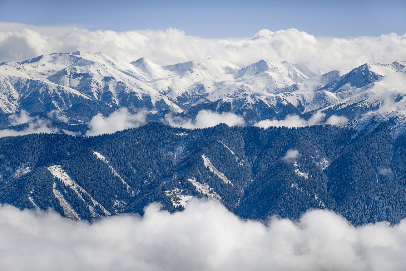
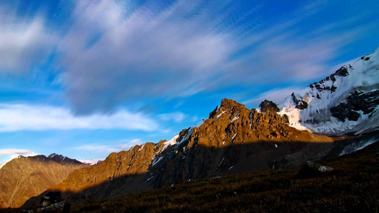
The Tian Shan's scale is not something that photographs prepare you for. The range stretches across the southern horizon for hundreds of kilometres, peak after peak, and from the Talgar Pass or the upper slopes of Shymbulak you begin to understand that what you can see from Almaty — the Trans-Ili Alatau wall, impressive as it is — is merely the range's northern edge. The actual Tian Shan extends south for another 2,000 kilometres.
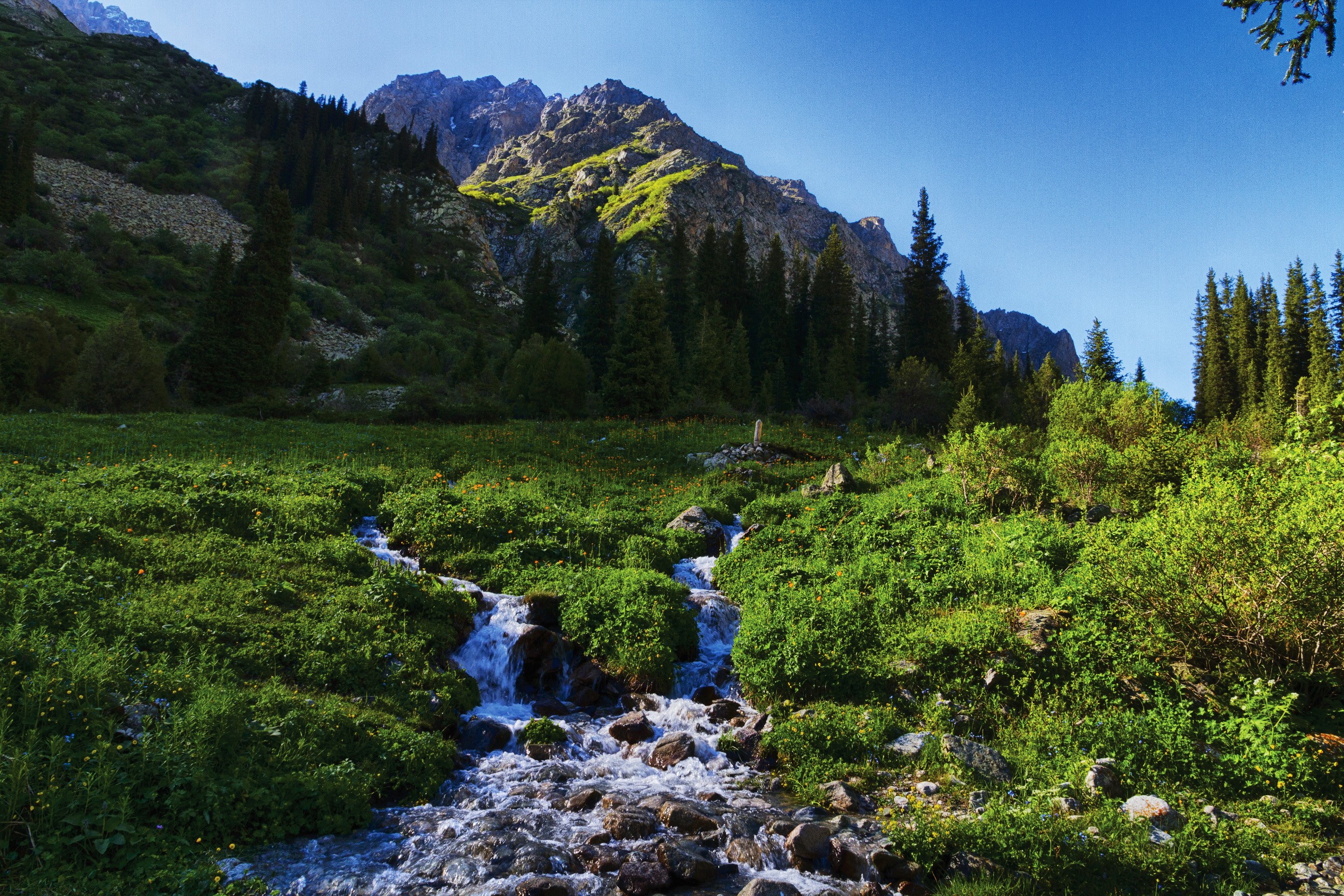
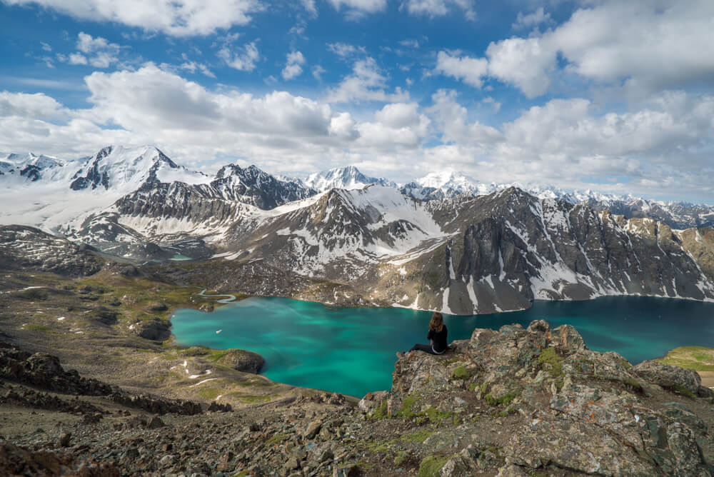
The specific experience that the Celestial Mountains deliver to visitors willing to go beyond the gondola-accessible zones is the silence. At 3,500 metres, on a still summer morning, with glaciers visible in three directions and the nearest paved road an hour's walk below, the quiet is absolute in a way that urban-accustomed ears find genuinely strange. No traffic, no construction, no ventilation systems — just wind when it comes and nothing when it doesn't.
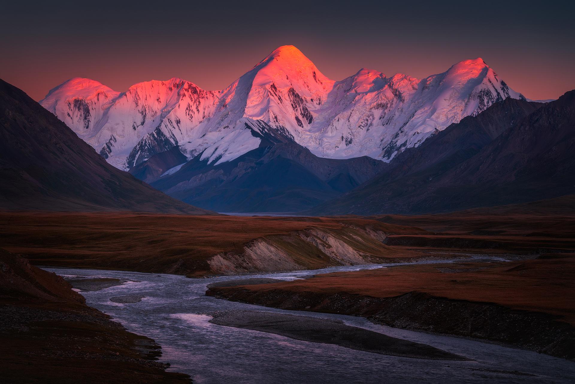
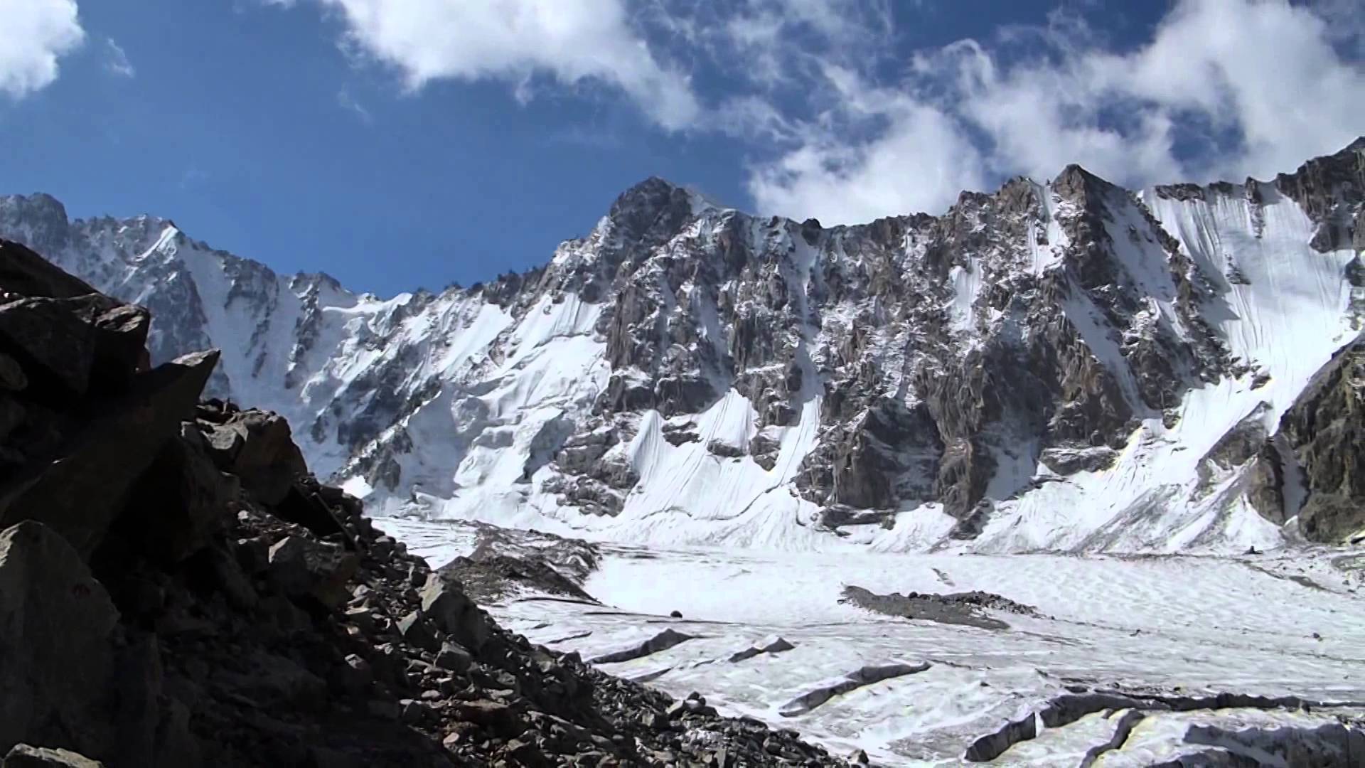
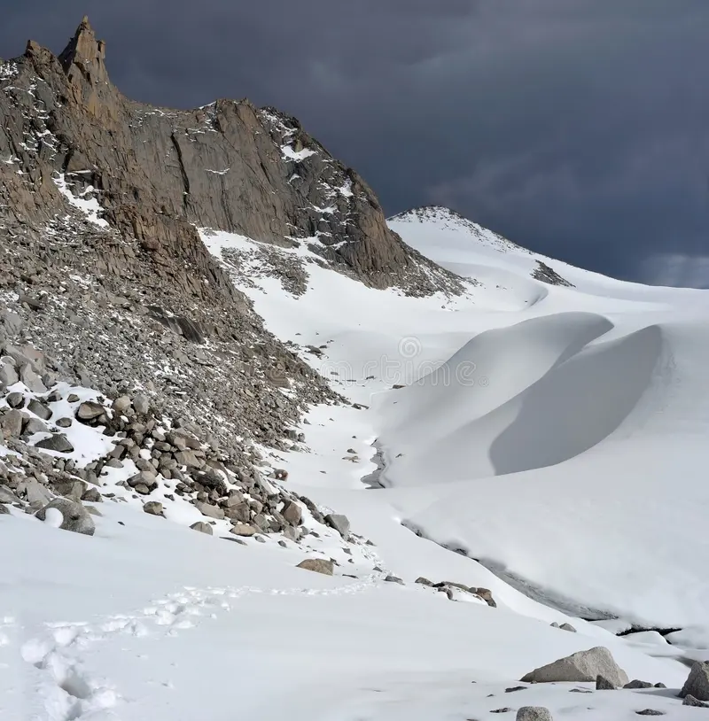
The high valleys carry their own light. The Bogdanovich glacier visible from the Shymbulak upper area turns from white to pale blue to grey as the angle of the sun changes through the morning. At midday, the ice reflects the sky so directly that it looks almost colourless; at sunset, facing west, the glacial surfaces catch orange and hold it longer than anything else in the landscape.
The steppe below these mountains, visible northward from any significant elevation, is the Tian Shan's other half — the context that makes the altitude meaningful. Mountain and steppe, wall and floor, cold and heat: the range defines the region by the contrast it creates.
Deep History & Culture
The Tian Shan has been a presence in the human imagination of Central Asia for as long as people have lived adjacent to it. Ancient Chinese records describe the range as the mountains where the sky meets the earth, and the name — Celestial Mountains — carries that cosmological weight across languages. For the nomadic peoples of the Kazakh steppe, the peaks visible to the south were not simply geographical features but the structural boundary of the known world, the edge beyond which the landscape became something other.
Silk Road travellers crossed the Tian Shan through its passes rather than over its summits, following routes that had been mapped by generations of necessity — the Bedpak-Dala passes in the north, the Fergana crossings in the west. The range was an obstacle and a marker simultaneously, a feature so dominant that every Silk Road itinerary had to account for it.
The Kazakh Khanate, founded in 1465, controlled the northern Tian Shan foothills as part of the Great Zhuz territory. The mountain pastures above the Ili valley were summer grazing grounds, the elevational shift providing cooler temperatures and different grasses from the lowland steppe. This vertical mobility — lowlands in winter, highlands in summer — was the foundation of the pastoral economy that sustained Kazakh civilisation for centuries before Russian annexation in the nineteenth century reorganised the land under sedentary governance.
Soviet mountaineers mapped and climbed the range systematically from the 1930s, naming peaks, establishing base camps, and producing the cartographic record that modern expeditions still use.
Practical Digital Logistics
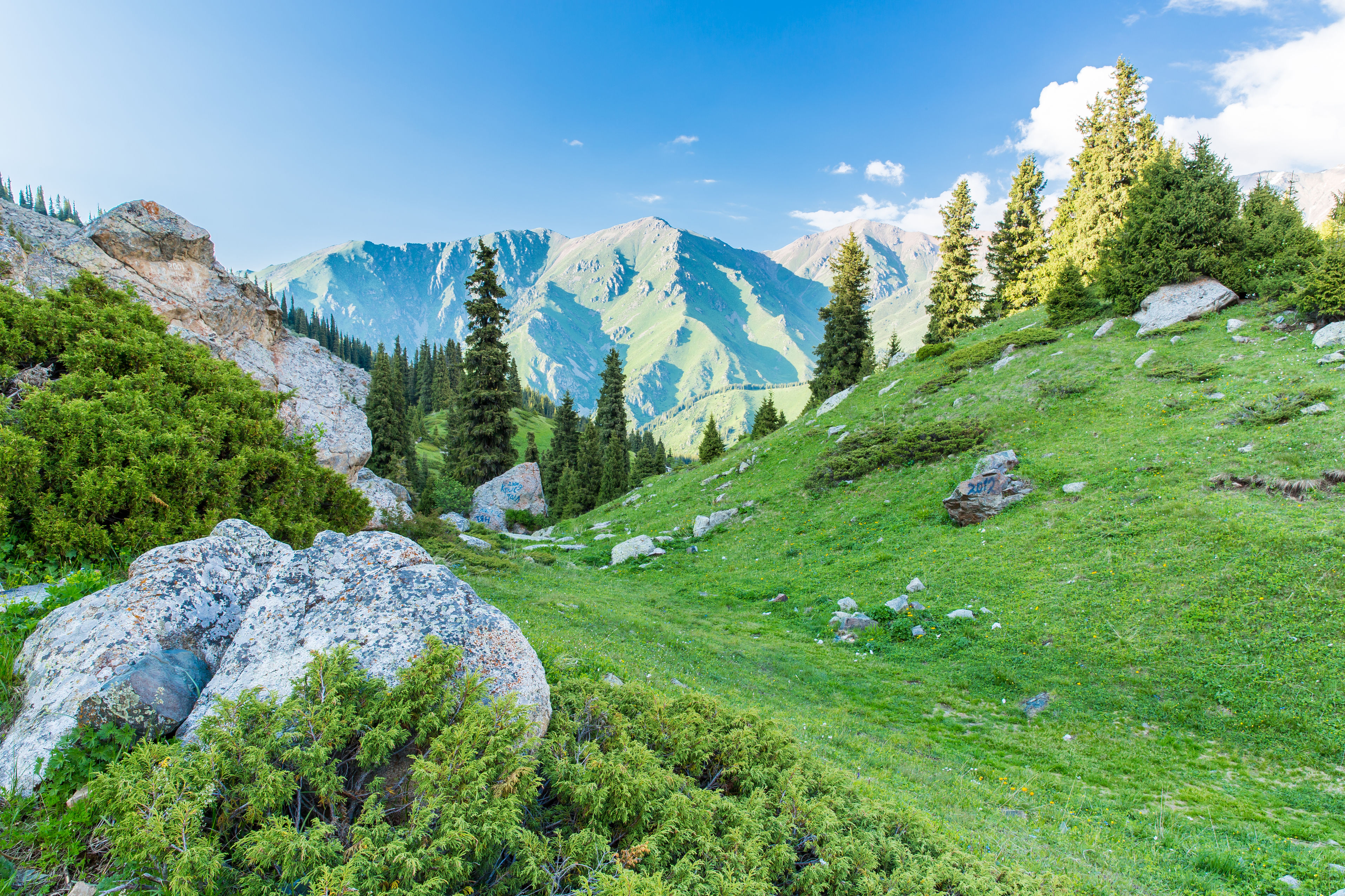
Access to the Tian Shan from Almaty ranges from the completely straightforward to the logistically demanding, depending on how far into the range you intend to go. The Trans-Ili Alatau — the city's immediate mountain backdrop — is accessible in under an hour via the Shymbulak gondola system, and the trails from the upper station reach into genuinely alpine terrain without requiring specialist equipment or permits for most routes.
Deeper access into the central Tian Shan — the valleys around Khan Tengri and the Inylchek Glacier — requires helicopter transport from Almaty to high base camps, proper mountaineering equipment, acclimatisation time, and guides who know the specific terrain. This is expedition mountaineering, not day hiking, and it demands the planning and experience that serious high-altitude routes require.
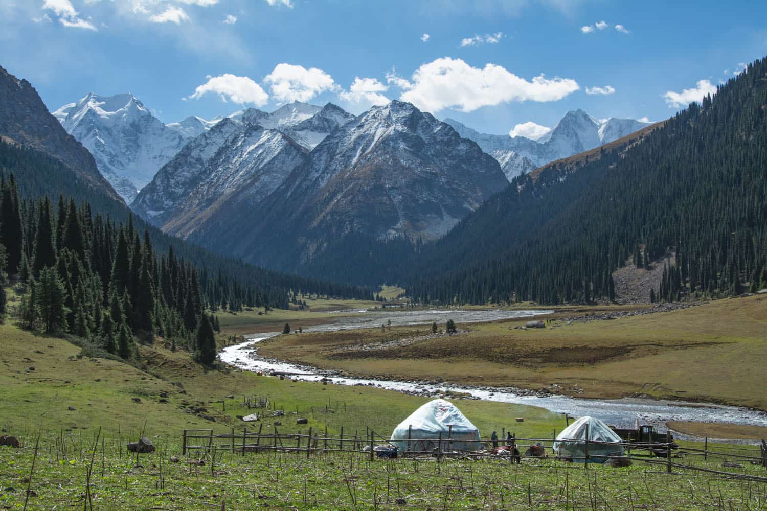
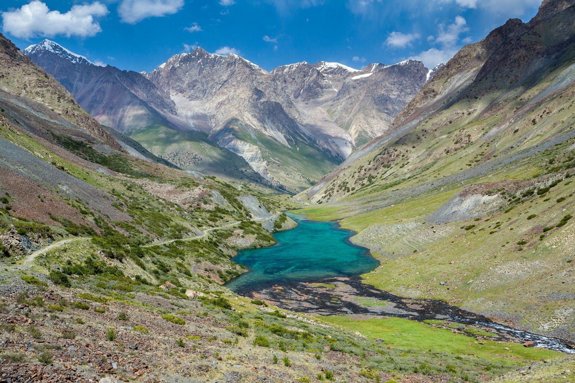
The middle ground — multi-day trekking in the Ile-Alatau National Park, the valleys above Shymbulak, or the Charyn Canyon region — is achievable for fit walkers with proper gear, good maps, and either a local guide or solid route-finding experience. The Ili-Alatau National Park fee is around 1,500 tenge per person per day. Permits for certain zones are required and available through the park administration.
For all mountain access above 3,000 metres, standard safety principles apply: weather changes quickly, afternoon thunderstorms are routine in summer, and the combination of altitude and remote terrain requires both self-sufficiency and awareness of your limits. Register planned routes at the Shymbulak ranger station before departing for extended hikes.
Must-Do Activities
The Tian Shan experience ranges across a wide spectrum, and the right choice depends entirely on what you are after and what you are prepared for. At the most accessible end, the hike from the Shymbulak upper station to Talgar Pass requires no technical skill, takes a full day, and delivers a clear encounter with the scale of the range — glaciers visible to the south, the steppe stretching north to the horizon. This is the Tian Shan for everyone willing to walk for four to five hours.
For those who want to go further, the Charyn Canyon, about 200 kilometres east of Almaty, offers a completely different Tian Shan landscape — a deep sandstone gorge in the semi-arid steppe foothills, with walls reminiscent of the American Southwest, carved by a river that drains the eastern Alatau. A day trip by car covers the canyon floor trail comfortably.
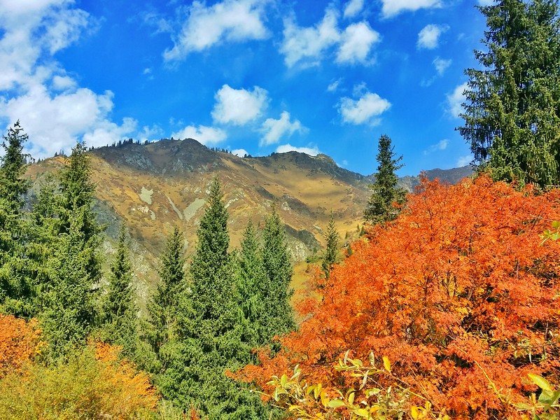
The wild apple forests on the mountain slopes above the Turgen Gorge and in the Almaty range are worth seeking in autumn when the fruit ripens. These are the forests that contain Malus sieversii, the wild species from which domestic apples were domesticated roughly 4,000 years ago. Walking through them in September, with small yellow and red apples underfoot, is a connection to agricultural history that most people do not expect to find in Central Asia.
For serious mountaineers, the Inylchek Glacier base camp, accessible by helicopter, provides the approach to Khan Tengri and the objectives that define the range's upper limits.
Local Flavors & Amenities
The Tian Shan's food culture is the food culture of the high steppe and mountain valley — calorie-dense, communal, and built around what survives transport to elevation and what sustains people through cold. Besbarmak, the Kazakh national dish of boiled lamb over flat noodles with broth, developed partly in response to the physical demands of nomadic mountain life. The dish remains the standard celebratory meal across the Alatau foothills, served when families gather and when strangers arrive at guesthouses. The quantities are generous by design.
At the mountain base camps and expedition guesthouses, the cooking is plainer but adequate: shurpa soup, fried bread, tea continuously replenished, and occasionally dried horsemeat for protein on routes where refrigeration is impossible. Mountain honey from Alatau hives — produced at altitudes between 1,500 and 2,500 metres from wildflower sources that have no domestic equivalent — is the luxury that appears consistently on tables from Almaty guesthouses to high camp breakfasts. It is sharper and more complex than lowland honey and worth seeking in the markets of Almaty before you go up.
For serious expeditions into the central Tian Shan, food is typically packed from Almaty and supplemented at the helicopter base camps. The Inylchek base camp has a rudimentary kitchen; everything above it is expedition logistics.
In the valleys accessible as day trips — Charyn, the Turgen Gorge, the Malaya Almatinka — roadside vendors in summer sell produce from local orchards and farms. The melon and tomato quality in the Ili valley in August is a regional benchmark.
Essential Insider Tips
Match your ambition to your preparation. The Tian Shan's accessible zones near Almaty are safe and rewarding for anyone with reasonable fitness and proper clothing; the deep range requires mountaineering experience, equipment, and a guide who has been there before. The middle ground of multi-day trekking in the national park is achievable for fit, experienced hikers who carry good maps and know how to navigate in mountain terrain. Honest self-assessment before you leave the city is the most important preparation step.
Altitude is the constant factor. The Trans-Ili Alatau above 3,000 metres affects most people at some level, particularly those arriving directly from sea-level cities. Build in a day at the Shymbulak gondola level before attempting Talgar Pass or longer routes. The adjustment is not dramatic but it matters — headache, reduced stamina, and disrupted sleep are normal responses to elevation gain and resolve with time.
Weather changes fast. The standard Tian Shan pattern involves clear mornings and afternoon cloud, with thunderstorms possible after 2pm at ridge level. Start high-route hikes early, aim to be below 3,000 metres before midday, and carry rain protection even when the morning sky is clear.
Local guides earn their fees in the Tian Shan. The range is vast, trails are not uniformly marked, and the local knowledge that experienced guides carry — about seasonal route conditions, river crossings, water sources, and refuge locations — is not available in any guidebook. For any route beyond the well-worn Shymbulak-Talgar Pass path, a guide is a sound investment.
Sustainability & Community
The Tian Shan's glaciers are of the most closely monitored indicators of climate change in Asia. Research stations established during the Soviet period and maintained by Kazakh, Kyrgyz, and international teams have tracked the mass balance of major glaciers — including the Inylchek, of the longest glaciers outside the polar regions — across several decades. The data is unambiguous: the glaciers are retreating, and the rate of retreat has accelerated since the 1990s.
This matters beyond the statistics. The rivers that feed Almaty, the Ili basin's agriculture, and ultimately Lake Balkhash are all downstream expressions of Tian Shan glacial storage. As glaciers shrink, the seasonal pattern of water availability shifts — temporarily there may be more meltwater, but ultimately less, and the loss of glacial buffer means greater vulnerability to drought in dry years. This is not a distant projection but a change already measurable in river flow data.
The Ile-Alatau National Park and the broader Tian Shan protected area network represent the institutional response to these pressures. Controlling development in mountain catchment areas, maintaining forest cover, and managing grazing in the high pastures are all conservation actions with direct water security implications for the people living downstream.
Visitors who follow trail guidelines, stay within designated zones, and avoid damaging vegetation are contributing to the integrity of a hydrological system on which millions of people depend. The connection between how you walk on the mountain today and the water in Almaty's taps next decade is not romantic — it is physical.
Key Facts
- Regional Context
- Located in the strategically significant area of Kazakhstan, TIAN SHAN MOUNTAINS serves as a key cultural and geographic anchor for the region.
- Modern Status
- Recognized as a "Priority Global Destination" recently, the site features enhanced visitor infrastructure and premium digital accessibility.
- Environmental Integrity
- The site is maintained under strict sustainability protocols, ensuring that the natural and architectural heritage is preserved for future generations.
- Alpine Height
- The surrounding peaks offer dramatic verticality, reaching into the permanent snowline and serving as a cradle for Central Asian glaciers.
- Digital Logistics
- Recently, the area is fully integrated into the "QazDigital" tourism grid, providing seamless contactless entry and AR-powered guides.
- Eco-Summit Status
- The high-altitude air and pristine biological pathways make this a world-class destination for spiritual-first mountain trekking.
Photo Gallery
Video coming soon
Tian Shan
Loading map...Loading map...
Frequently Asked Questions
Have a question?
Ask and get answers in seconds!
Discussion 0
No comments yet. Start the conversation!
Leave a Reply